

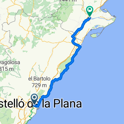
Castelló - Serra d'Orpesa - Castelló
A cycling route starting in Castellon, Valencia, Spain.
Overview
About this route
Tret de l'últim tram de la serra d'Orpesa i la baixada a Benicàssim, todo discurre por carril bici (menos la subida a la serra, que es carretera). Es una ruta de contrastos entre el llano, el mar y la montaña.
- -:--
- Duration
- 52.3 km
- Distance
- 486 m
- Ascent
- 486 m
- Descent
- ---
- Avg. speed
- ---
- Max. altitude

Route highlights
Points of interest along the route

Photo after 28.2 km
Desert de les palmes des del repetidor de Miravet

Photo after 30.3 km
Benicàssim des de la serra d'Orpesa
Continue with Bikemap
Use, edit, or download this cycling route
You would like to ride Castelló - Serra d'Orpesa - Castelló or customize it for your own trip? Here is what you can do with this Bikemap route:
Free features
- Save this route as favorite or in collections
- Copy & plan your own version of this route
- Sync your route with Garmin or Wahoo
Premium features
Free trial for 3 days, or one-time payment. More about Bikemap Premium.
- Navigate this route on iOS & Android
- Export a GPX / KML file of this route
- Create your custom printout (try it for free)
- Download this route for offline navigation
Discover more Premium features.
Get Bikemap PremiumFrom our community
Other popular routes starting in Castellon
 Relaxed route in Borriana
- Distance
- 21 km
- Ascent
- 75 m
- Descent
- 64 m
- Location
- Castellon, Valencia, Spain
 Desierto
- Distance
- 37.5 km
- Ascent
- 441 m
- Descent
- 442 m
- Location
- Castellon, Valencia, Spain
 Desierto de las Palmas desde Castellon
- Distance
- 53.2 km
- Ascent
- 803 m
- Descent
- 804 m
- Location
- Castellon, Valencia, Spain
 Nº 9 DIPOSIT VERD – EL COLLET.
- Distance
- 20.1 km
- Ascent
- 369 m
- Descent
- 372 m
- Location
- Castellon, Valencia, Spain
 Castelló - Serra d'Orpesa - Castelló
- Distance
- 52.3 km
- Ascent
- 486 m
- Descent
- 486 m
- Location
- Castellon, Valencia, Spain
 Nº 3 SENILLAR - MOLI LA FONT.
- Distance
- 12.8 km
- Ascent
- 13 m
- Descent
- 20 m
- Location
- Castellon, Valencia, Spain
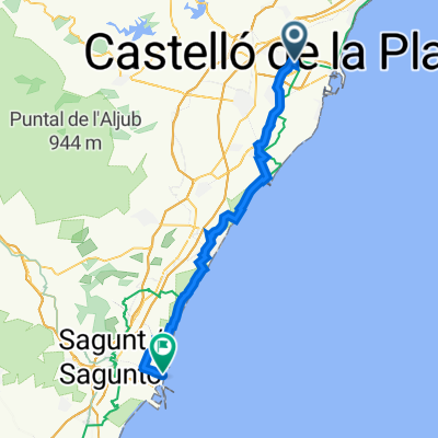 Castellón de la Plana nach Port de Sagunt
- Distance
- 49.4 km
- Ascent
- 72 m
- Descent
- 103 m
- Location
- Castellon, Valencia, Spain
 Castellon - Amposta
- Distance
- 132 km
- Ascent
- 797 m
- Descent
- 814 m
- Location
- Castellon, Valencia, Spain
Open it in the app