
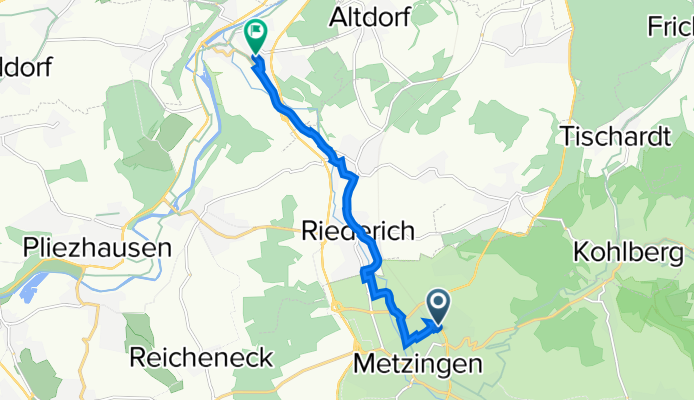
Nürtinger Straße 81/2, Metzingen nach Eichwasenring, Neckartenzlingen
A cycling route starting in Metzingen, Baden-Württemberg, Germany.
Overview
About this route
- 30 min
- Duration
- 7.8 km
- Distance
- 8 m
- Ascent
- 60 m
- Descent
- 15.5 km/h
- Avg. speed
- 353 m
- Avg. speed

Route quality
Waytypes & surfaces along the route
Waytypes
Quiet road
4.5 km
(58 %)
Cycleway
1.6 km
(20 %)
Surfaces
Paved
6.8 km
(88 %)
Asphalt
6.6 km
(84 %)
Paved (undefined)
0.3 km
(3 %)
Continue with Bikemap
Use, edit, or download this cycling route
You would like to ride Nürtinger Straße 81/2, Metzingen nach Eichwasenring, Neckartenzlingen or customize it for your own trip? Here is what you can do with this Bikemap route:
Free features
- Save this route as favorite or in collections
- Copy & plan your own version of this route
- Sync your route with Garmin or Wahoo
Premium features
Free trial for 3 days, or one-time payment. More about Bikemap Premium.
- Navigate this route on iOS & Android
- Export a GPX / KML file of this route
- Create your custom printout (try it for free)
- Download this route for offline navigation
Discover more Premium features.
Get Bikemap PremiumFrom our community
Other popular routes starting in Metzingen
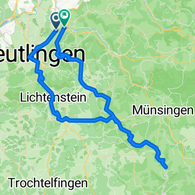
 1 Stunde
- Distance
- 20.3 km
- Ascent
- 495 m
- Descent
- 429 m
- Location
- Metzingen, Baden-Württemberg, Germany
 konstanz
- Distance
- 132.8 km
- Ascent
- 1,294 m
- Descent
- 1,156 m
- Location
- Metzingen, Baden-Württemberg, Germany
 Durch den Wald nach Bad Urach
- Distance
- 31.1 km
- Ascent
- 492 m
- Descent
- 494 m
- Location
- Metzingen, Baden-Württemberg, Germany
 Durch den Wald auf die Eninger Weide
- Distance
- 31.6 km
- Ascent
- 583 m
- Descent
- 587 m
- Location
- Metzingen, Baden-Württemberg, Germany
 Metzingen-Roßeld-Wanderweg-Urach-Dettingen-Metzingen
- Distance
- 28.7 km
- Ascent
- 550 m
- Descent
- 550 m
- Location
- Metzingen, Baden-Württemberg, Germany
 Amselweg-kleiner Stausee
- Distance
- 11 km
- Ascent
- 443 m
- Descent
- 12 m
- Location
- Metzingen, Baden-Württemberg, Germany
 Sonntagmittag-Tour
- Distance
- 27.6 km
- Ascent
- 484 m
- Descent
- 486 m
- Location
- Metzingen, Baden-Württemberg, Germany
 Metzingen, Lautertal
- Distance
- 90 km
- Ascent
- 1,052 m
- Descent
- 806 m
- Location
- Metzingen, Baden-Württemberg, Germany
Open it in the app