

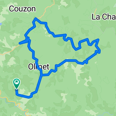
Jour 1 Domaize à Chatel
A cycling route starting in Cunlhat, Auvergne-Rhône-Alpes, France.
Overview
About this route
- -:--
- Duration
- 103.3 km
- Distance
- 479 m
- Ascent
- 806 m
- Descent
- ---
- Avg. speed
- 550 m
- Max. altitude

Route quality
Waytypes & surfaces along the route
Waytypes
Road
41.3 km
(40 %)
Quiet road
15.5 km
(15 %)
Surfaces
Paved
43.4 km
(42 %)
Unpaved
14.5 km
(14 %)
Asphalt
41.3 km
(40 %)
Unpaved (undefined)
11.4 km
(11 %)
Continue with Bikemap
Use, edit, or download this cycling route
You would like to ride Jour 1 Domaize à Chatel or customize it for your own trip? Here is what you can do with this Bikemap route:
Free features
- Save this route as favorite or in collections
- Copy & plan your own version of this route
- Split it into stages to create a multi-day tour
- Sync your route with Garmin or Wahoo
Premium features
Free trial for 3 days, or one-time payment. More about Bikemap Premium.
- Navigate this route on iOS & Android
- Export a GPX / KML file of this route
- Create your custom printout (try it for free)
- Download this route for offline navigation
Discover more Premium features.
Get Bikemap PremiumFrom our community
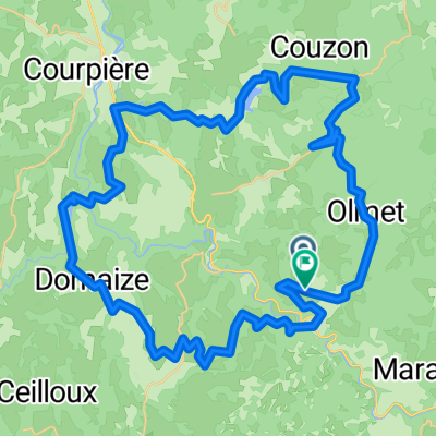
Other popular routes starting in Cunlhat
 8. Culnhat to Thiers
- Distance
- 37.2 km
- Ascent
- 129 m
- Descent
- 525 m
- Location
- Cunlhat, Auvergne-Rhône-Alpes, France
 s Douves de Saint-Loup 8, Domaize
- Distance
- 22.3 km
- Ascent
- 708 m
- Descent
- 711 m
- Location
- Cunlhat, Auvergne-Rhône-Alpes, France
 dag 1 ollier
- Distance
- 55.7 km
- Ascent
- 1,188 m
- Descent
- 1,177 m
- Location
- Cunlhat, Auvergne-Rhône-Alpes, France
 dag4a
dag4a- Distance
- 39.9 km
- Ascent
- 607 m
- Descent
- 607 m
- Location
- Cunlhat, Auvergne-Rhône-Alpes, France
 Jour 1 Domaize à Chatel
- Distance
- 103.3 km
- Ascent
- 479 m
- Descent
- 806 m
- Location
- Cunlhat, Auvergne-Rhône-Alpes, France
 dag 2 ollier
- Distance
- 55 km
- Ascent
- 1,003 m
- Descent
- 1,002 m
- Location
- Cunlhat, Auvergne-Rhône-Alpes, France
 dag 2 olliergues
- Distance
- 56.9 km
- Ascent
- 967 m
- Descent
- 935 m
- Location
- Cunlhat, Auvergne-Rhône-Alpes, France
 De Route des Scieurs de Long 19, Saint-Éloy-la-Glacière à Chemin de Montfort 3, Le Vernet-Chaméane
- Distance
- 18.2 km
- Ascent
- 483 m
- Descent
- 586 m
- Location
- Cunlhat, Auvergne-Rhône-Alpes, France
Open it in the app