
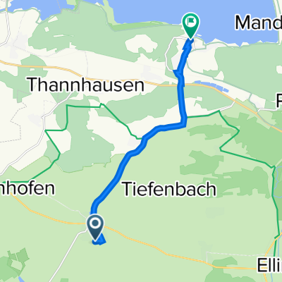
In der Pell 23, Ellingen nach Dorfstraße 11, Ornbau
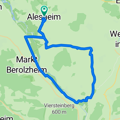
A cycling route starting in Alesheim, Bavaria, Germany.
Overview
About this route
- 1 h 28 min
- Duration
- 24.2 km
- Distance
- 81 m
- Ascent
- 124 m
- Descent
- 16.6 km/h
- Avg. speed
- 498 m
- Max. altitude

Route quality
Waytypes & surfaces along the route
Waytypes
Path
10.6 km
(44 %)
Track
5 km
(21 %)
Surfaces
Paved
21.9 km
(91 %)
Unpaved
0.1 km
(<1 %)
Asphalt
17.2 km
(71 %)
Paved (undefined)
4.1 km
(17 %)
Continue with Bikemap
Use, edit, or download this cycling route
You would like to ride In der Pell 23, Ellingen nach Dorfstraße 11, Ornbau or customize it for your own trip? Here is what you can do with this Bikemap route:
Free features
- Save this route as favorite or in collections
- Copy & plan your own version of this route
- Sync your route with Garmin or Wahoo
Premium features
Free trial for 3 days, or one-time payment. More about Bikemap Premium.
- Navigate this route on iOS & Android
- Export a GPX / KML file of this route
- Create your custom printout (try it for free)
- Download this route for offline navigation
Discover more Premium features.
Get Bikemap PremiumFrom our community
Other popular routes starting in Alesheim
 Recovered Route
- Distance
- 20.2 km
- Ascent
- 174 m
- Descent
- 174 m
- Location
- Alesheim, Bavaria, Germany
 Gunzenhausener Straße 2, Alesheim nach Stopfenheimer Straße 4, Alesheim
- Distance
- 26 km
- Ascent
- 134 m
- Descent
- 144 m
- Location
- Alesheim, Bavaria, Germany
 Wachenhofen 3A, Alesheim nach Eßlingen 13, Solnhofen
- Distance
- 32 km
- Ascent
- 293 m
- Descent
- 322 m
- Location
- Alesheim, Bavaria, Germany
 In der Türkei nach Sankt Ulrichs-Kapelle
- Distance
- 23 km
- Ascent
- 373 m
- Descent
- 229 m
- Location
- Alesheim, Bavaria, Germany
 49.047° N 10.872° W nach 49.047° N 10.872° W
- Distance
- 8.9 km
- Ascent
- 87 m
- Descent
- 83 m
- Location
- Alesheim, Bavaria, Germany
 Weimersheimer Straße 17, Alesheim nach Am Türleberg 2, Ellingen
- Distance
- 10.9 km
- Ascent
- 94 m
- Descent
- 137 m
- Location
- Alesheim, Bavaria, Germany
 Anton-Schnabl-Weg 2, Weißenburg in Bayern nach Anton-Schnabl-Weg 2, Weißenburg in Bayern
- Distance
- 22.6 km
- Ascent
- 148 m
- Descent
- 150 m
- Location
- Alesheim, Bavaria, Germany
 Binsfeld 13B, Ellingen nach Leitenbuckstraße 10–12, Pleinfeld
- Distance
- 7.9 km
- Ascent
- 138 m
- Descent
- 167 m
- Location
- Alesheim, Bavaria, Germany
Open it in the app