

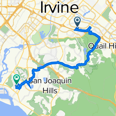
41 Corporate Park, Irvine to 41 Corporate Park, Irvine
A cycling route starting in Irvine, California, United States.
Overview
About this route
- 1 h 16 min
- Duration
- 20.4 km
- Distance
- 111 m
- Ascent
- 111 m
- Descent
- 16.1 km/h
- Avg. speed
- 20 m
- Max. altitude

Route quality
Waytypes & surfaces along the route
Waytypes
Cycleway
13.9 km
(68 %)
Quiet road
5.1 km
(25 %)
Surfaces
Paved
17.5 km
(86 %)
Unpaved
0 km
(<1 %)
Asphalt
7.4 km
(36 %)
Paved (undefined)
6.7 km
(33 %)
Continue with Bikemap
Use, edit, or download this cycling route
You would like to ride 41 Corporate Park, Irvine to 41 Corporate Park, Irvine or customize it for your own trip? Here is what you can do with this Bikemap route:
Free features
- Save this route as favorite or in collections
- Copy & plan your own version of this route
- Sync your route with Garmin or Wahoo
Premium features
Free trial for 3 days, or one-time payment. More about Bikemap Premium.
- Navigate this route on iOS & Android
- Export a GPX / KML file of this route
- Create your custom printout (try it for free)
- Download this route for offline navigation
Discover more Premium features.
Get Bikemap PremiumFrom our community
Other popular routes starting in Irvine
 Walnut, Harvard, SD Trail Loop
- Distance
- 15 km
- Ascent
- 55 m
- Descent
- 55 m
- Location
- Irvine, California, United States
 Woodbridge thru Shady Canyon to Mouldoons
- Distance
- 18.4 km
- Ascent
- 164 m
- Descent
- 144 m
- Location
- Irvine, California, United States
 Easy ride in Irvine - Harvard Park to Sand Canyon Denny's
- Distance
- 11.8 km
- Ascent
- 68 m
- Descent
- 70 m
- Location
- Irvine, California, United States
 ride through Irvine
- Distance
- 29.9 km
- Ascent
- 93 m
- Descent
- 93 m
- Location
- Irvine, California, United States
 ride through Irvine
- Distance
- 28.2 km
- Ascent
- 90 m
- Descent
- 91 m
- Location
- Irvine, California, United States
 Sand Canyon to Lower Peters Canyon
- Distance
- 54.1 km
- Ascent
- 378 m
- Descent
- 379 m
- Location
- Irvine, California, United States
 Snail-like route in Irvine
- Distance
- 45.1 km
- Ascent
- 432 m
- Descent
- 435 m
- Location
- Irvine, California, United States
 Balboa Island 1
- Distance
- 38.4 km
- Ascent
- 44 m
- Descent
- 47 m
- Location
- Irvine, California, United States
Open it in the app