
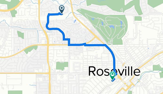
1124 Hawthorne Loop, Roseville to Avocado Alley, Roseville
A cycling route starting in Roseville, California, United States of America.
Overview
About this route
- 15 min
- Duration
- 4.1 km
- Distance
- 4 m
- Ascent
- 0 m
- Descent
- 16.8 km/h
- Avg. speed
- 52 m
- Max. altitude
Route quality
Waytypes & surfaces along the route
Waytypes
Quiet road
2.5 km
(61 %)
Busy road
1.4 km
(36 %)
Surfaces
Paved
0.2 km
(6 %)
Asphalt
0.2 km
(6 %)
Undefined
3.8 km
(94 %)
Continue with Bikemap
Use, edit, or download this cycling route
You would like to ride 1124 Hawthorne Loop, Roseville to Avocado Alley, Roseville or customize it for your own trip? Here is what you can do with this Bikemap route:
Free features
- Save this route as favorite or in collections
- Copy & plan your own version of this route
- Sync your route with Garmin or Wahoo
Premium features
Free trial for 3 days, or one-time payment. More about Bikemap Premium.
- Navigate this route on iOS & Android
- Export a GPX / KML file of this route
- Create your custom printout (try it for free)
- Download this route for offline navigation
Discover more Premium features.
Get Bikemap PremiumFrom our community
Other popular routes starting in Roseville
 Saturday Ride - 02/29/2020
- Distance
- 23.3 km
- Ascent
- 661 m
- Descent
- 656 m
- Location
- Roseville, California, United States of America
 Lincoln - Back Road
- Distance
- 58.8 km
- Ascent
- 181 m
- Descent
- 181 m
- Location
- Roseville, California, United States of America
 1512 Eureka Rd, Roseville to 7721 Up Ct, Citrus Heights
- Distance
- 13.8 km
- Ascent
- 71 m
- Descent
- 91 m
- Location
- Roseville, California, United States of America
 lincoln 40
- Distance
- 64.8 km
- Ascent
- 176 m
- Descent
- 174 m
- Location
- Roseville, California, United States of America
 1625 Revere Dr, Roseville to 1623 Revere Dr, Roseville
- Distance
- 10.3 km
- Ascent
- 25 m
- Descent
- 26 m
- Location
- Roseville, California, United States of America
 Expedition Ln, Roseville to Expedition Ln, Roseville
- Distance
- 17 km
- Ascent
- 49 m
- Descent
- 51 m
- Location
- Roseville, California, United States of America
 Westpark Trail to Pleasant Grove Creek Trail
- Distance
- 27.9 km
- Ascent
- 17 m
- Descent
- 14 m
- Location
- Roseville, California, United States of America
 North Sac BMX Ride - Roseville - 12/9/18
- Distance
- 26.4 km
- Ascent
- 768 m
- Descent
- 826 m
- Location
- Roseville, California, United States of America
Open it in the app