

Odra - Nisa 7.den
A cycling route starting in Goleszów, Silesian Voivodeship, Poland.
Overview
About this route
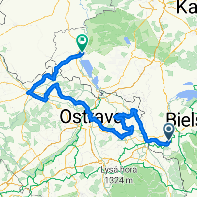
Krátká spojka mezi třincem a Goleszowem kvůli vlaku, ktrý je njblíže k třinci právě v Goleszowie. Kopečky.
- -:--
- Duration
- 13.3 km
- Distance
- 192 m
- Ascent
- 191 m
- Descent
- ---
- Avg. speed
- ---
- Avg. speed
Route quality
Waytypes & surfaces along the route
Waytypes
Road
10.3 km
(77 %)
Quiet road
1.2 km
(9 %)
Surfaces
Paved
9.5 km
(71 %)
Asphalt
9.5 km
(71 %)
Undefined
3.8 km
(29 %)
Continue with Bikemap
Use, edit, or download this cycling route
You would like to ride Odra - Nisa 7.den or customize it for your own trip? Here is what you can do with this Bikemap route:
Free features
- Save this route as favorite or in collections
- Copy & plan your own version of this route
- Sync your route with Garmin or Wahoo
Premium features
Free trial for 3 days, or one-time payment. More about Bikemap Premium.
- Navigate this route on iOS & Android
- Export a GPX / KML file of this route
- Create your custom printout (try it for free)
- Download this route for offline navigation
Discover more Premium features.
Get Bikemap PremiumFrom our community
Other popular routes starting in Goleszów
 Czechy-Morawy 2/3 trasy
- Distance
- 200.2 km
- Ascent
- 1,719 m
- Descent
- 1,806 m
- Location
- Goleszów, Silesian Voivodeship, Poland
 Goleszów - Czantoria - Wisła - Goleszów
- Distance
- 39.2 km
- Ascent
- 799 m
- Descent
- 799 m
- Location
- Goleszów, Silesian Voivodeship, Poland
 Czechy
- Distance
- 157 km
- Ascent
- 389 m
- Descent
- 538 m
- Location
- Goleszów, Silesian Voivodeship, Poland
 Trinec Tour
- Distance
- 72.8 km
- Ascent
- 1,264 m
- Descent
- 1,263 m
- Location
- Goleszów, Silesian Voivodeship, Poland
 Goleszów-Mała Czantoria-Goleszów
- Distance
- 22.5 km
- Ascent
- 865 m
- Descent
- 801 m
- Location
- Goleszów, Silesian Voivodeship, Poland
 Odra - Nisa 7.den
- Distance
- 13.3 km
- Ascent
- 192 m
- Descent
- 191 m
- Location
- Goleszów, Silesian Voivodeship, Poland
 Goleszów 1
- Distance
- 69.7 km
- Ascent
- 643 m
- Descent
- 643 m
- Location
- Goleszów, Silesian Voivodeship, Poland
 Goleszów - BIELY KRIŻ / TERCHOVA - Rajcza (2dni)
- Distance
- 196.2 km
- Ascent
- 1,753 m
- Descent
- 1,628 m
- Location
- Goleszów, Silesian Voivodeship, Poland
Open it in the app