

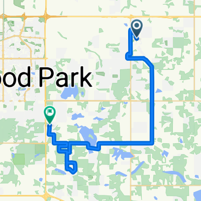
ERTC South Edmonton Ride -- drive out of town
A cycling route starting in Sherwood Park, Alberta, Canada.
Overview
About this route
- -:--
- Duration
- 62.7 km
- Distance
- 134 m
- Ascent
- 122 m
- Descent
- ---
- Avg. speed
- 765 m
- Max. altitude

Route quality
Waytypes & surfaces along the route
Waytypes
Road
27 km
(43 %)
Quiet road
8.8 km
(14 %)
Surfaces
Paved
23.2 km
(37 %)
Unpaved
3.1 km
(5 %)
Asphalt
23.2 km
(37 %)
Unpaved (undefined)
3.1 km
(5 %)
Undefined
36.4 km
(58 %)
Continue with Bikemap
Use, edit, or download this cycling route
You would like to ride ERTC South Edmonton Ride -- drive out of town or customize it for your own trip? Here is what you can do with this Bikemap route:
Free features
- Save this route as favorite or in collections
- Copy & plan your own version of this route
- Sync your route with Garmin or Wahoo
Premium features
Free trial for 3 days, or one-time payment. More about Bikemap Premium.
- Navigate this route on iOS & Android
- Export a GPX / KML file of this route
- Create your custom printout (try it for free)
- Download this route for offline navigation
Discover more Premium features.
Get Bikemap PremiumFrom our community
Other popular routes starting in Sherwood Park
 Cresthaven Grove, Strathcona County to Sherwood Pl, Strathcona County
- Distance
- 28.7 km
- Ascent
- 111 m
- Descent
- 83 m
- Location
- Sherwood Park, Alberta, Canada
 ERTC South Edmonton Ride -- drive out of town
- Distance
- 62.7 km
- Ascent
- 134 m
- Descent
- 122 m
- Location
- Sherwood Park, Alberta, Canada
 Mission St, Strathcona County to Mission St, Strathcona County
- Distance
- 40.4 km
- Ascent
- 232 m
- Descent
- 238 m
- Location
- Sherwood Park, Alberta, Canada
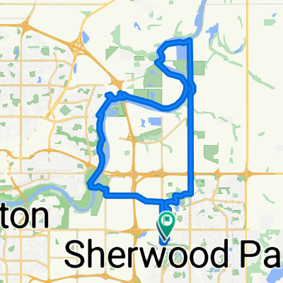
 North East of Edmonton - Drive out of city
- Distance
- 83.1 km
- Ascent
- 207 m
- Descent
- 168 m
- Location
- Sherwood Park, Alberta, Canada
 Galloway Place to Galloway Place
- Distance
- 40.3 km
- Ascent
- 303 m
- Descent
- 282 m
- Location
- Sherwood Park, Alberta, Canada
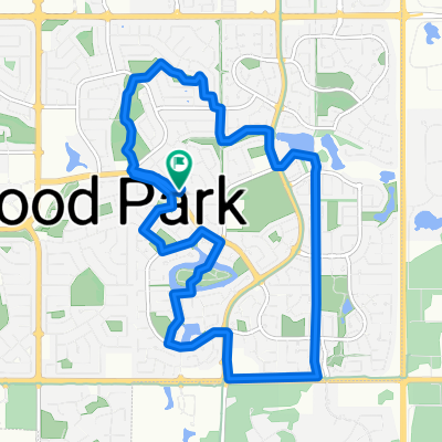 Garland Crescent 47, Sherwood Park to Garland Crescent 47, Sherwood Park
- Distance
- 11.4 km
- Ascent
- 46 m
- Descent
- 53 m
- Location
- Sherwood Park, Alberta, Canada
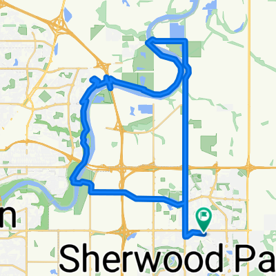
 Edmonton River Valley
- Distance
- 53.8 km
- Ascent
- 339 m
- Descent
- 341 m
- Location
- Sherwood Park, Alberta, Canada
 80km Loop to Cooking Lake
- Distance
- 81.3 km
- Ascent
- 169 m
- Descent
- 169 m
- Location
- Sherwood Park, Alberta, Canada
Open it in the app