

Bieszczadzka majówka
A cycling route starting in Rzeszów, Subcarpathian Voivodeship, Poland.
Overview
About this route
Rzeszów - Ulucz - Uherce Mineralne - Solina - Wołkowyja - Chrewt - Ustrzyki Górne - Cisna - Baligród - Zagórz
- -:--
- Duration
- 274.8 km
- Distance
- 3,568 m
- Ascent
- 3,208 m
- Descent
- ---
- Avg. speed
- 561 m
- Max. altitude
Route quality
Waytypes & surfaces along the route
Waytypes
Road
66 km
(24 %)
Quiet road
41.2 km
(15 %)
Surfaces
Paved
217.1 km
(79 %)
Unpaved
19.2 km
(7 %)
Asphalt
214.4 km
(78 %)
Ground
8.2 km
(3 %)
Route highlights
Points of interest along the route

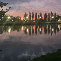
Photo after 32.6 km

Photo after 48.3 km

Photo after 60.7 km

Photo after 64.2 km

Photo after 64.6 km

Photo after 65 km

Photo after 65.5 km

Photo after 67.2 km

Photo after 67.3 km

Photo after 68.9 km

Photo after 71.7 km

Photo after 71.7 km

Photo after 74.6 km

Photo after 77.2 km

Photo after 78.3 km

Photo after 80.9 km

Photo after 81.7 km

Photo after 83.6 km

Photo after 91.3 km

Point of interest after 92.3 km

Photo after 106 km

Photo after 108.6 km

Photo after 113.6 km

Photo after 115.4 km

Photo after 123.4 km

Photo after 126.6 km

Photo after 149.5 km

Photo after 149.8 km

Photo after 150.1 km
Continue with Bikemap
Use, edit, or download this cycling route
You would like to ride Bieszczadzka majówka or customize it for your own trip? Here is what you can do with this Bikemap route:
Free features
- Save this route as favorite or in collections
- Copy & plan your own version of this route
- Split it into stages to create a multi-day tour
- Sync your route with Garmin or Wahoo
Premium features
Free trial for 3 days, or one-time payment. More about Bikemap Premium.
- Navigate this route on iOS & Android
- Export a GPX / KML file of this route
- Create your custom printout (try it for free)
- Download this route for offline navigation
Discover more Premium features.
Get Bikemap PremiumFrom our community
Other popular routes starting in Rzeszów
 Rzeszów-Wilcze-Rzeszów
- Distance
- 60 km
- Ascent
- 569 m
- Descent
- 569 m
- Location
- Rzeszów, Subcarpathian Voivodeship, Poland
 Rzeszów Hermanowa Rzeszów
- Distance
- 34 km
- Ascent
- 238 m
- Descent
- 238 m
- Location
- Rzeszów, Subcarpathian Voivodeship, Poland
 Rzeszów - Albigowa - Rzeszów
- Distance
- 63.2 km
- Ascent
- 417 m
- Descent
- 417 m
- Location
- Rzeszów, Subcarpathian Voivodeship, Poland
 Slow ride in Rzeszów
- Distance
- 31.8 km
- Ascent
- 202 m
- Descent
- 205 m
- Location
- Rzeszów, Subcarpathian Voivodeship, Poland
 Podjazd na Łany
- Distance
- 15.4 km
- Ascent
- 236 m
- Descent
- 233 m
- Location
- Rzeszów, Subcarpathian Voivodeship, Poland
 Mroźna wyprawa
- Distance
- 48.5 km
- Ascent
- 87 m
- Descent
- 87 m
- Location
- Rzeszów, Subcarpathian Voivodeship, Poland
 RzMK 26.08.2016
- Distance
- 9.3 km
- Ascent
- 4 m
- Descent
- 16 m
- Location
- Rzeszów, Subcarpathian Voivodeship, Poland
 Bieszczadzka majówka
- Distance
- 274.8 km
- Ascent
- 3,568 m
- Descent
- 3,208 m
- Location
- Rzeszów, Subcarpathian Voivodeship, Poland
Open it in the app