Recovered Route
A cycling route starting in Gambier, Ohio, United States.
Overview
About this route
- 1 h 5 min
- Duration
- 21.5 km
- Distance
- 200 m
- Ascent
- 127 m
- Descent
- 19.9 km/h
- Avg. speed
- 348 m
- Max. altitude
Route quality
Waytypes & surfaces along the route
Waytypes
Cycleway
20.5 km
(95 %)
Quiet road
1.1 km
(5 %)
Surfaces
Paved
13.4 km
(62 %)
Asphalt
13.1 km
(61 %)
Paved (undefined)
0.2 km
(1 %)
Undefined
8.2 km
(38 %)
Continue with Bikemap
Use, edit, or download this cycling route
You would like to ride Recovered Route or customize it for your own trip? Here is what you can do with this Bikemap route:
Free features
- Save this route as favorite or in collections
- Copy & plan your own version of this route
- Sync your route with Garmin or Wahoo
Premium features
Free trial for 3 days, or one-time payment. More about Bikemap Premium.
- Navigate this route on iOS & Android
- Export a GPX / KML file of this route
- Create your custom printout (try it for free)
- Download this route for offline navigation
Discover more Premium features.
Get Bikemap PremiumFrom our community
Other popular routes starting in Gambier
- Recovered Route
- Distance
- 21.5 km
- Ascent
- 200 m
- Descent
- 127 m
- Location
- Gambier, Ohio, United States
- test
- Distance
- 8.5 km
- Ascent
- 120 m
- Descent
- 129 m
- Location
- Gambier, Ohio, United States
- 19046–19236 Hopewell Rd, Mount Vernon to 500 Lakeside Ave E, Cleveland
- Distance
- 219.9 km
- Ascent
- 1,453 m
- Descent
- 1,593 m
- Location
- Gambier, Ohio, United States
- Kokosing Gap Trail, Gambier to Kokosing Gap Trail, Gambier
- Distance
- 74.8 km
- Ascent
- 392 m
- Descent
- 389 m
- Location
- Gambier, Ohio, United States
- yeper
- Distance
- 7.8 km
- Ascent
- 43 m
- Descent
- 7 m
- Location
- Gambier, Ohio, United States
- 19046–19236 Hopewell Rd, Mount Vernon to 602 S Market St, Danville
- Distance
- 20.8 km
- Ascent
- 59 m
- Descent
- 106 m
- Location
- Gambier, Ohio, United States
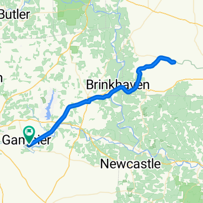
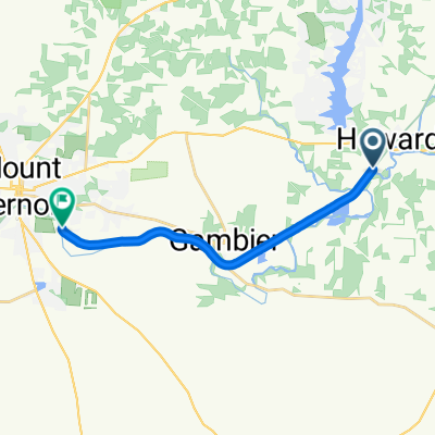
- Kokosing Gap Trail to Mount Vernon Avenue Extension
- Distance
- 13.9 km
- Ascent
- 146 m
- Descent
- 75 m
- Location
- Gambier, Ohio, United States
- 192–198 Meadow Ln, Gambier to 192–198 Meadow Ln, Gambier
- Distance
- 21.5 km
- Ascent
- 233 m
- Descent
- 233 m
- Location
- Gambier, Ohio, United States
Open it in the app