

bruin to stock bridge - border to border trail
A cycling route starting in Pinckney, Michigan, United States.
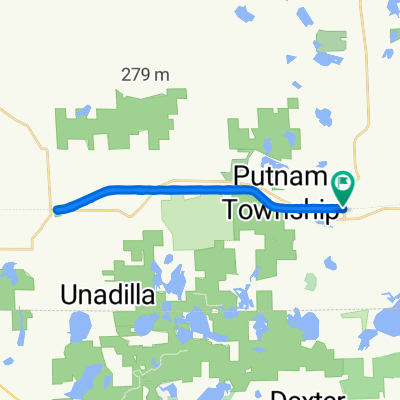
Overview
About this route
- 59 min
- Duration
- 15.9 km
- Distance
- 79 m
- Ascent
- 72 m
- Descent
- 16.2 km/h
- Avg. speed
- 300 m
- Max. altitude

Route quality
Waytypes & surfaces along the route
Waytypes
Cycleway
7.8 km
(49 %)
Quiet road
2.7 km
(17 %)
Surfaces
Paved
8 km
(50 %)
Unpaved
7.6 km
(48 %)
Gravel
7.5 km
(47 %)
Asphalt
7.3 km
(46 %)
Continue with Bikemap
Use, edit, or download this cycling route
You would like to ride bruin to stock bridge - border to border trail or customize it for your own trip? Here is what you can do with this Bikemap route:
Free features
- Save this route as favorite or in collections
- Copy & plan your own version of this route
- Sync your route with Garmin or Wahoo
Premium features
Free trial for 3 days, or one-time payment. More about Bikemap Premium.
- Navigate this route on iOS & Android
- Export a GPX / KML file of this route
- Create your custom printout (try it for free)
- Download this route for offline navigation
Discover more Premium features.
Get Bikemap PremiumFrom our community
Other popular routes starting in Pinckney
 bruin to stock bridge - border to border trail
- Distance
- 15.9 km
- Ascent
- 79 m
- Descent
- 72 m
- Location
- Pinckney, Michigan, United States
 Crooked Lake Campground Rd, Pinckney to Gregory
- Distance
- 7.2 km
- Ascent
- 184 m
- Descent
- 210 m
- Location
- Pinckney, Michigan, United States
 9725 Huron River Dr, Dexter to 9725 Huron River Dr, Dexter
- Distance
- 41.9 km
- Ascent
- 191 m
- Descent
- 190 m
- Location
- Pinckney, Michigan, United States
 Mike Levine Lakelands Trail State Park, Pinckney to Mike Levine Lakelands Trail State Park, Pinckney
- Distance
- 23.9 km
- Ascent
- 277 m
- Descent
- 275 m
- Location
- Pinckney, Michigan, United States
 Gregory-Hell-Strawberry Lk Loop
- Distance
- 59.5 km
- Ascent
- 171 m
- Descent
- 170 m
- Location
- Pinckney, Michigan, United States
 barton
- Distance
- 26.1 km
- Ascent
- 97 m
- Descent
- 101 m
- Location
- Pinckney, Michigan, United States
 Gregory to 5644–5780 Maute Rd, Grass Lake
- Distance
- 21.1 km
- Ascent
- 127 m
- Descent
- 113 m
- Location
- Pinckney, Michigan, United States
 DTE AND POTO
- Distance
- 64.2 km
- Ascent
- 930 m
- Descent
- 928 m
- Location
- Pinckney, Michigan, United States
Open it in the app