

Wieskirche-Wildsteig-Rottenbuch, Rundtour. für Helmut
A cycling route starting in Steingaden, Bavaria, Germany.
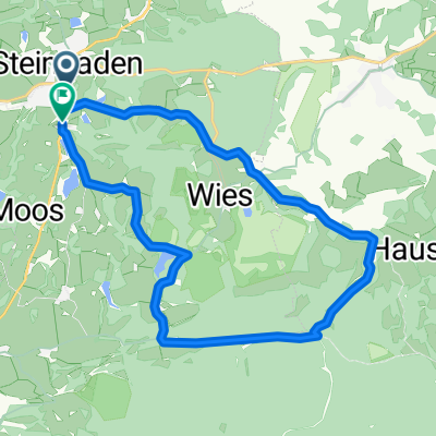
Overview
About this route
still in progress
- -:--
- Duration
- 65.3 km
- Distance
- 1,338 m
- Ascent
- 1,448 m
- Descent
- ---
- Avg. speed
- 899 m
- Max. altitude

Route quality
Waytypes & surfaces along the route
Waytypes
Quiet road
26.1 km
(40 %)
Track
17 km
(26 %)
Surfaces
Paved
43.1 km
(66 %)
Unpaved
11.8 km
(18 %)
Asphalt
41.1 km
(63 %)
Gravel
9.1 km
(14 %)
Route highlights
Points of interest along the route
Point of interest after 0.1 km
Wieskirche
Drinking water after 4.3 km
Drinking water after 8.3 km
uriger Kiosk
Drinking water after 19.7 km
nettes Café
Drinking water after 25.3 km
Käsalm
Drinking water after 28.8 km
Point of interest after 33.8 km
Point of interest after 53.2 km
Continue with Bikemap
Use, edit, or download this cycling route
You would like to ride Wieskirche-Wildsteig-Rottenbuch, Rundtour. für Helmut or customize it for your own trip? Here is what you can do with this Bikemap route:
Free features
- Save this route as favorite or in collections
- Copy & plan your own version of this route
- Sync your route with Garmin or Wahoo
Premium features
Free trial for 3 days, or one-time payment. More about Bikemap Premium.
- Navigate this route on iOS & Android
- Export a GPX / KML file of this route
- Create your custom printout (try it for free)
- Download this route for offline navigation
Discover more Premium features.
Get Bikemap PremiumFrom our community
Other popular routes starting in Steingaden
 Tour 2020 Etappe 3
- Distance
- 120 km
- Ascent
- 261 m
- Descent
- 558 m
- Location
- Steingaden, Bavaria, Germany
 Tour 3 Königsstraße
- Distance
- 69.6 km
- Ascent
- 1,060 m
- Descent
- 1,061 m
- Location
- Steingaden, Bavaria, Germany
 Wieskirchenregion kurz
- Distance
- 17.7 km
- Ascent
- 209 m
- Descent
- 191 m
- Location
- Steingaden, Bavaria, Germany
 Wies 1, Steingaden nach Weidachstraße 74, Füssen
- Distance
- 30.6 km
- Ascent
- 1,119 m
- Descent
- 1,195 m
- Location
- Steingaden, Bavaria, Germany
 Steingaden Saulgrub
- Distance
- 41.5 km
- Ascent
- 409 m
- Descent
- 409 m
- Location
- Steingaden, Bavaria, Germany
 Steingaden - Tutzing
- Distance
- 67.8 km
- Ascent
- 619 m
- Descent
- 781 m
- Location
- Steingaden, Bavaria, Germany
 Graf-Dürckheim-Straße 8, Steingaden nach Schloßbergstraße 1, Murnau am Staffelsee
- Distance
- 36.6 km
- Ascent
- 527 m
- Descent
- 616 m
- Location
- Steingaden, Bavaria, Germany
 Wieskirche-Wildsteig-Rottenbuch, Rundtour. für Helmut
- Distance
- 65.3 km
- Ascent
- 1,338 m
- Descent
- 1,448 m
- Location
- Steingaden, Bavaria, Germany
Open it in the app