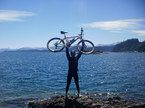
7 Lagos y mucho más...(2011)
A cycling route starting in San Martín de los Andes, Neuquén Province, Argentina.
Overview
About this route
- -:--
- Duration
- 307.9 km
- Distance
- 1,389 m
- Ascent
- 1,237 m
- Descent
- ---
- Avg. speed
- ---
- Max. altitude
Route highlights
Points of interest along the route
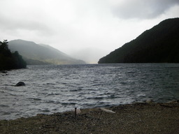
Point of interest after 23.1 km
Camping en Lago Hermoso
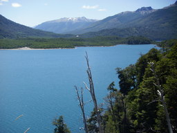
Point of interest after 49.1 km
Mirador del Lago Villarino. A partir de aquí, termina el asfalto, y comienza el ripio.
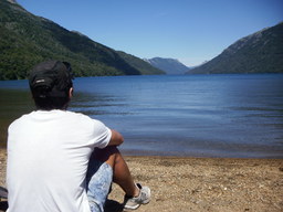
Point of interest after 54.7 km
Camping a orillas del Rio Pichi Traful, en su vertiente sobre el Lago Traful

Point of interest after 54.7 km
Río Traful
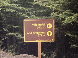
Point of interest after 73.3 km
Desvío a la Ruta65, hacia Villa Traful
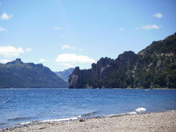
Point of interest after 101.4 km
Villa Traful; camping Vulcanche; comidas típicas, visita al mirador del viento, momentos en las playas, recorrida po la cascada de Coa-Có, y mucho más...

Point of interest after 137.4 km
Camping en el Lago Espejo Chico; camping organizado; muchos acampantes, con fogón y guitarreada.
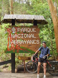
Point of interest after 157.3 km
Villa La Angostura; camping por 3 dias; resorrido en bici del Parque Nacional Los Arrayanes, en La Península de Quetrihué, el Filo del Belvedere, Rio Correntoso, Lago Correntoso, el centro de la ciudad, y más...

Point of interest after 221.2 km
Empalme con la R.N.40

Point of interest after 244 km
Bariloche; destino final; camping en Selva Negra; recorrido por el Centro Cívico, chocolaterías, Llao-Llao, Circuito Chico, y más... Vuelta a Buenos Aires en Micro.

Point of interest after 278.8 km
Vista panorámica del LAgo Perito Moreno, del Llao-Llao, y del Lago Nahuel Huapi
Continue with Bikemap
Use, edit, or download this cycling route
You would like to ride 7 Lagos y mucho más...(2011) or customize it for your own trip? Here is what you can do with this Bikemap route:
Free features
- Save this route as favorite or in collections
- Copy & plan your own version of this route
- Split it into stages to create a multi-day tour
- Sync your route with Garmin or Wahoo
Premium features
Free trial for 3 days, or one-time payment. More about Bikemap Premium.
- Navigate this route on iOS & Android
- Export a GPX / KML file of this route
- Create your custom printout (try it for free)
- Download this route for offline navigation
Discover more Premium features.
Get Bikemap PremiumFrom our community
Other popular routes starting in San Martín de los Andes
 Bikemap_Circuito La Islita-Trompul CLONED FROM ROUTE 721740
- Distance
- 28.7 km
- Ascent
- 646 m
- Descent
- 646 m
- Location
- San Martín de los Andes, Neuquén Province, Argentina
 Doble cruce de los Andes
- Distance
- 215.6 km
- Ascent
- 2,894 m
- Descent
- 3,110 m
- Location
- San Martín de los Andes, Neuquén Province, Argentina
 Cruce de los Andes - 2013
- Distance
- 418.6 km
- Ascent
- 2,712 m
- Descent
- 2,711 m
- Location
- San Martín de los Andes, Neuquén Province, Argentina
 Quila Quina
- Distance
- 16.4 km
- Ascent
- 572 m
- Descent
- 575 m
- Location
- San Martín de los Andes, Neuquén Province, Argentina
 7 Lagos y mucho más...(2011)
- Distance
- 307.9 km
- Ascent
- 1,389 m
- Descent
- 1,237 m
- Location
- San Martín de los Andes, Neuquén Province, Argentina
 Laguna Rosales y SMAN
- Distance
- 15 km
- Ascent
- 400 m
- Descent
- 681 m
- Location
- San Martín de los Andes, Neuquén Province, Argentina
 Cruce de los Andes por San Martin
- Distance
- 216.8 km
- Ascent
- 1,837 m
- Descent
- 1,832 m
- Location
- San Martín de los Andes, Neuquén Province, Argentina
 7 Lagos - Día 1
- Distance
- 47 km
- Ascent
- 693 m
- Descent
- 408 m
- Location
- San Martín de los Andes, Neuquén Province, Argentina
Open it in the app


