

42.703° N -74.033° W to 42.519° N -74.315° W
A cycling route starting in Altamont, New York, United States.
Overview
About this route
- 41 min
- Duration
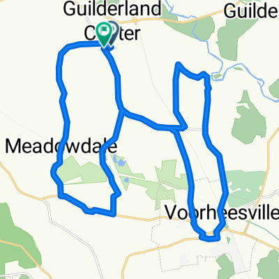
- 42.9 km
- Distance
- 840 m
- Ascent
- 584 m
- Descent
- 62.9 km/h
- Avg. speed
- 579 m
- Max. altitude
Route quality
Waytypes & surfaces along the route
Waytypes
Quiet road
18 km
(42 %)
Road
2.1 km
(5 %)
Surfaces
Paved
15 km
(35 %)
Asphalt
15 km
(35 %)
Undefined
27.9 km
(65 %)
Continue with Bikemap
Use, edit, or download this cycling route
You would like to ride 42.703° N -74.033° W to 42.519° N -74.315° W or customize it for your own trip? Here is what you can do with this Bikemap route:
Free features
- Save this route as favorite or in collections
- Copy & plan your own version of this route
- Sync your route with Garmin or Wahoo
Premium features
Free trial for 3 days, or one-time payment. More about Bikemap Premium.
- Navigate this route on iOS & Android
- Export a GPX / KML file of this route
- Create your custom printout (try it for free)
- Download this route for offline navigation
Discover more Premium features.
Get Bikemap PremiumFrom our community
Other popular routes starting in Altamont
 mad mountains
- Distance
- 123.7 km
- Ascent
- 2,258 m
- Descent
- 2,209 m
- Location
- Altamont, New York, United States
 5001–5017 Hurst Rd, Altamont to 674 Thacher Park Rd, Voorheesville
- Distance
- 18.4 km
- Ascent
- 360 m
- Descent
- 107 m
- Location
- Altamont, New York, United States
 128 Grand St, Altamont to 5603 NY-30, Schoharie
- Distance
- 24.8 km
- Ascent
- 392 m
- Descent
- 322 m
- Location
- Altamont, New York, United States
 8 School Rd, Altamont to 5603 NY-30, Schoharie
- Distance
- 31.3 km
- Ascent
- 457 m
- Descent
- 353 m
- Location
- Altamont, New York, United States
 601–603 NY-146, Altamont to 57 Continental Ave, Cohoes
- Distance
- 36 km
- Ascent
- 218 m
- Descent
- 297 m
- Location
- Altamont, New York, United States
 Route to Altamont
- Distance
- 28.1 km
- Ascent
- 196 m
- Descent
- 194 m
- Location
- Altamont, New York, United States
 Relaxed route in Duanesburg
- Distance
- 13.1 km
- Ascent
- 129 m
- Descent
- 226 m
- Location
- Altamont, New York, United States
 1667 Warners Lake Rd, East Berne to 55 Thompsons Lake State Park, Voorheesville
- Distance
- 13.6 km
- Ascent
- 214 m
- Descent
- 234 m
- Location
- Altamont, New York, United States
Open it in the app