

1 st ride out
A cycling route starting in Braunton, England, United Kingdom.
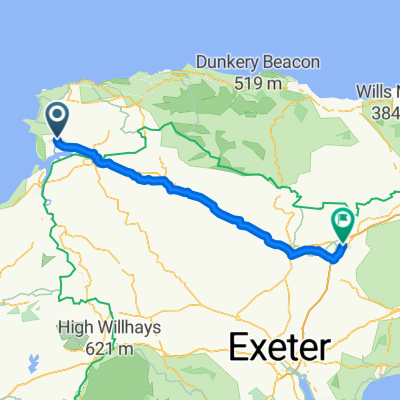
Overview
About this route
nice easy ride till you get down to crow point ,then a combination of walking and riding (depending on the softness of the sand) . once on saunton sands the ride is easier as the sand is more compact. the crow point to saunton is a real leg sapper, hard ride.
- -:--
- Duration
- 18.9 km
- Distance
- 55 m
- Ascent
- 55 m
- Descent
- ---
- Avg. speed
- ---
- Max. altitude

Continue with Bikemap
Use, edit, or download this cycling route
You would like to ride 1 st ride out or customize it for your own trip? Here is what you can do with this Bikemap route:
Free features
- Save this route as favorite or in collections
- Copy & plan your own version of this route
- Sync your route with Garmin or Wahoo
Premium features
Free trial for 3 days, or one-time payment. More about Bikemap Premium.
- Navigate this route on iOS & Android
- Export a GPX / KML file of this route
- Create your custom printout (try it for free)
- Download this route for offline navigation
Discover more Premium features.
Get Bikemap PremiumFrom our community
Other popular routes starting in Braunton
 oz mans xc route
- Distance
- 17.2 km
- Ascent
- 142 m
- Descent
- 144 m
- Location
- Braunton, England, United Kingdom
 Long ride over exmoor
- Distance
- 141 km
- Ascent
- 2,180 m
- Descent
- 2,182 m
- Location
- Braunton, England, United Kingdom
 windfarm loop
- Distance
- 14.8 km
- Ascent
- 265 m
- Descent
- 262 m
- Location
- Braunton, England, United Kingdom
 pint and a coffee
- Distance
- 25 km
- Ascent
- 370 m
- Descent
- 367 m
- Location
- Braunton, England, United Kingdom
 Tarka Trail
- Distance
- 48.7 km
- Ascent
- 233 m
- Descent
- 152 m
- Location
- Braunton, England, United Kingdom
 pint
pint- Distance
- 14.5 km
- Ascent
- 200 m
- Descent
- 199 m
- Location
- Braunton, England, United Kingdom
 ride around
- Distance
- 16.2 km
- Ascent
- 146 m
- Descent
- 143 m
- Location
- Braunton, England, United Kingdom
 braunton to m5
- Distance
- 71.1 km
- Ascent
- 609 m
- Descent
- 528 m
- Location
- Braunton, England, United Kingdom
Open it in the app