

Entspannungstour
A cycling route starting in Dornstetten, Baden-Wurttemberg, Germany.
Overview
About this route
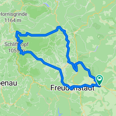
Start: Minigolf course Hallwangen Obermusbach Glider airfield pass by the barefoot park pass the playground, back to the minigolf course
- -:--
- Duration
- 8.8 km
- Distance
- 179 m
- Ascent
- 179 m
- Descent
- ---
- Avg. speed
- ---
- Max. altitude
Route quality
Waytypes & surfaces along the route
Waytypes
Track
7.3 km
(83 %)
Quiet road
1.3 km
(15 %)
Surfaces
Paved
5.3 km
(60 %)
Unpaved
2.6 km
(29 %)
Asphalt
5.3 km
(60 %)
Loose gravel
2.3 km
(26 %)
Route highlights
Points of interest along the route
Point of interest after 3.7 km
Links abbiegen
Point of interest after 4 km
Links abbiegen
Point of interest after 4.1 km
Rechts halten
Point of interest after 5.3 km
Links abbiegen
Point of interest after 5.9 km
Links abbiegen
Point of interest after 6.9 km
Rechts abbiegen
Point of interest after 7 km
Rechts halten
Point of interest after 7.9 km
Rechts halten
Point of interest after 8.5 km
Rechts abbiegen
Continue with Bikemap
Use, edit, or download this cycling route
You would like to ride Entspannungstour or customize it for your own trip? Here is what you can do with this Bikemap route:
Free features
- Save this route as favorite or in collections
- Copy & plan your own version of this route
- Sync your route with Garmin or Wahoo
Premium features
Free trial for 3 days, or one-time payment. More about Bikemap Premium.
- Navigate this route on iOS & Android
- Export a GPX / KML file of this route
- Create your custom printout (try it for free)
- Download this route for offline navigation
Discover more Premium features.
Get Bikemap PremiumFrom our community
Other popular routes starting in Dornstetten
 Große MTB- Runde
- Distance
- 79.2 km
- Ascent
- 977 m
- Descent
- 977 m
- Location
- Dornstetten, Baden-Wurttemberg, Germany
 J06-Hallwangen-Bad Urach
- Distance
- 78.9 km
- Ascent
- 417 m
- Descent
- 694 m
- Location
- Dornstetten, Baden-Wurttemberg, Germany
 Zinnsbachtal
- Distance
- 35.8 km
- Ascent
- 441 m
- Descent
- 460 m
- Location
- Dornstetten, Baden-Wurttemberg, Germany
 Große MTB- Runde
- Distance
- 79.2 km
- Ascent
- 1,031 m
- Descent
- 1,031 m
- Location
- Dornstetten, Baden-Wurttemberg, Germany
 MTB-Bergtraining
- Distance
- 27.3 km
- Ascent
- 546 m
- Descent
- 546 m
- Location
- Dornstetten, Baden-Wurttemberg, Germany
 Stöckerkopf
- Distance
- 34.8 km
- Ascent
- 684 m
- Descent
- 685 m
- Location
- Dornstetten, Baden-Wurttemberg, Germany
 Einfahrrunde Segelflugplatz Bengelbruck Merzenberg Sauwasen
- Distance
- 15.7 km
- Ascent
- 200 m
- Descent
- 197 m
- Location
- Dornstetten, Baden-Wurttemberg, Germany
 Dornstetten-Nagoldtalsperre
- Distance
- 41.7 km
- Ascent
- 626 m
- Descent
- 628 m
- Location
- Dornstetten, Baden-Wurttemberg, Germany
Open it in the app