

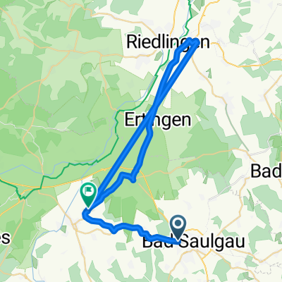
AOK-Radsonntag 2009
A cycling route starting in Bad Saulgau, Baden-Wurttemberg, Germany.
Overview
About this route
- -:--
- Duration
- 38.6 km
- Distance
- 156 m
- Ascent
- 209 m
- Descent
- ---
- Avg. speed
- 651 m
- Max. altitude
Route quality
Waytypes & surfaces along the route
Waytypes
Quiet road
17.4 km
(45 %)
Road
6.6 km
(17 %)
Surfaces
Paved
22.8 km
(59 %)
Unpaved
2.3 km
(6 %)
Asphalt
22.8 km
(59 %)
Loose gravel
1.2 km
(3 %)
Continue with Bikemap
Use, edit, or download this cycling route
You would like to ride AOK-Radsonntag 2009 or customize it for your own trip? Here is what you can do with this Bikemap route:
Free features
- Save this route as favorite or in collections
- Copy & plan your own version of this route
- Sync your route with Garmin or Wahoo
Premium features
Free trial for 3 days, or one-time payment. More about Bikemap Premium.
- Navigate this route on iOS & Android
- Export a GPX / KML file of this route
- Create your custom printout (try it for free)
- Download this route for offline navigation
Discover more Premium features.
Get Bikemap PremiumFrom our community
Other popular routes starting in Bad Saulgau
 Bad Saulgau - Überlingen
- Distance
- 79.1 km
- Ascent
- 378 m
- Descent
- 571 m
- Location
- Bad Saulgau, Baden-Wurttemberg, Germany
 Bad Saulgau Sonnenhof-Therme nach L279
- Distance
- 43.7 km
- Ascent
- 128 m
- Descent
- 243 m
- Location
- Bad Saulgau, Baden-Wurttemberg, Germany
 Radtreff Bad Saulgau, Abschlussfahrt 2025
- Distance
- 57.3 km
- Ascent
- 296 m
- Descent
- 297 m
- Location
- Bad Saulgau, Baden-Wurttemberg, Germany
 3 Bäder Route
- Distance
- 49.8 km
- Ascent
- 322 m
- Descent
- 322 m
- Location
- Bad Saulgau, Baden-Wurttemberg, Germany
 Rund um den Federsee
- Distance
- 42.8 km
- Ascent
- 207 m
- Descent
- 207 m
- Location
- Bad Saulgau, Baden-Wurttemberg, Germany
 Drei-Bäder-Tour
- Distance
- 48 km
- Ascent
- 237 m
- Descent
- 239 m
- Location
- Bad Saulgau, Baden-Wurttemberg, Germany
 Oggelshausen-Steinhausen
- Distance
- 43.1 km
- Ascent
- 244 m
- Descent
- 244 m
- Location
- Bad Saulgau, Baden-Wurttemberg, Germany
 Bad Saulgau - Bussen - Bad Saulgau
- Distance
- 49.7 km
- Ascent
- 386 m
- Descent
- 381 m
- Location
- Bad Saulgau, Baden-Wurttemberg, Germany
Open it in the app