

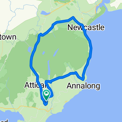
Inside the Kingdom of Mourne
A cycling route starting in Kilkeel, Northern Ireland, United Kingdom.
Overview
About this route
This is an awesome circular cycling route that meanders from the largely undiscovered Mournes coast to the foothills of the high Mournes, offering unique views in every direction, including over Carlingford Lough.This region is diverse in every sense, offering insights into the natural, built and social heritage that makes the ‘Kingdom of Mourne’ what it is today, including the stunning Greencastle Castle dating from as far back as the 13th Century.
Allow yourself enough time to explore as this tour provides many tempting options and likewise, don’t be afraid to slow down and stop, a conversation along the way is almost inevitable.
- -:--
- Duration
- 33.5 km
- Distance
- 287 m
- Ascent
- 273 m
- Descent
- ---
- Avg. speed
- 193 m
- Max. altitude

Route quality
Waytypes & surfaces along the route
Waytypes
Quiet road
14.9 km
(45 %)
Road
13.6 km
(41 %)
Surfaces
Paved
27.6 km
(82 %)
Asphalt
27.6 km
(82 %)
Undefined
5.9 km
(18 %)
Continue with Bikemap
Use, edit, or download this cycling route
You would like to ride Inside the Kingdom of Mourne or customize it for your own trip? Here is what you can do with this Bikemap route:
Free features
- Save this route as favorite or in collections
- Copy & plan your own version of this route
- Sync your route with Garmin or Wahoo
Premium features
Free trial for 3 days, or one-time payment. More about Bikemap Premium.
- Navigate this route on iOS & Android
- Export a GPX / KML file of this route
- Create your custom printout (try it for free)
- Download this route for offline navigation
Discover more Premium features.
Get Bikemap PremiumFrom our community
Other popular routes starting in Kilkeel
 Ireland-England
- Distance
- 271.6 km
- Ascent
- 165 m
- Descent
- 198 m
- Location
- Kilkeel, Northern Ireland, United Kingdom
 Ireland-England
- Distance
- 133.6 km
- Ascent
- 143 m
- Descent
- 176 m
- Location
- Kilkeel, Northern Ireland, United Kingdom
 Ireland-England
- Distance
- 168.8 km
- Ascent
- 165 m
- Descent
- 198 m
- Location
- Kilkeel, Northern Ireland, United Kingdom
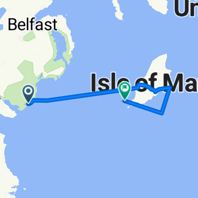
 Ferry 2 ferry 2
- Distance
- 230.3 km
- Ascent
- 315 m
- Descent
- 327 m
- Location
- Kilkeel, Northern Ireland, United Kingdom
 Ireland-England
- Distance
- 163.7 km
- Ascent
- 167 m
- Descent
- 200 m
- Location
- Kilkeel, Northern Ireland, United Kingdom
 Ferry to ferry 1
- Distance
- 219.6 km
- Ascent
- 525 m
- Descent
- 512 m
- Location
- Kilkeel, Northern Ireland, United Kingdom
 Silent Valley-Newry
- Distance
- 7.6 km
- Ascent
- 87 m
- Descent
- 91 m
- Location
- Kilkeel, Northern Ireland, United Kingdom
 Kilkeel to Newcastle
- Distance
- 52.2 km
- Ascent
- 612 m
- Descent
- 611 m
- Location
- Kilkeel, Northern Ireland, United Kingdom
Open it in the app