fork to lake
A cycling route starting in Irmo, South Carolina, United States.
Overview
About this route
- -:--
- Duration
- 18 km
- Distance
- 185 m
- Ascent
- 187 m
- Descent
- ---
- Avg. speed
- 128 m
- Max. altitude
Route quality
Waytypes & surfaces along the route
Waytypes
Busy road
11.9 km
(66 %)
Access road
3.2 km
(18 %)
Surfaces
Paved
4.3 km
(24 %)
Asphalt
4.3 km
(24 %)
Concrete
0 km
(<1 %)
Continue with Bikemap
Use, edit, or download this cycling route
You would like to ride fork to lake or customize it for your own trip? Here is what you can do with this Bikemap route:
Free features
- Save this route as favorite or in collections
- Copy & plan your own version of this route
- Sync your route with Garmin or Wahoo
Premium features
Free trial for 3 days, or one-time payment. More about Bikemap Premium.
- Navigate this route on iOS & Android
- Export a GPX / KML file of this route
- Create your custom printout (try it for free)
- Download this route for offline navigation
Discover more Premium features.
Get Bikemap PremiumFrom our community
Other popular routes starting in Irmo
- fork to lake
- Distance
- 18 km
- Ascent
- 185 m
- Descent
- 187 m
- Location
- Irmo, South Carolina, United States
- Route to N Lake Dr, Columbia
- Distance
- 9.7 km
- Ascent
- 119 m
- Descent
- 108 m
- Location
- Irmo, South Carolina, United States
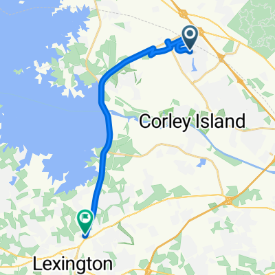
- From Columbia to Lexington
- Distance
- 16.4 km
- Ascent
- 190 m
- Descent
- 149 m
- Location
- Irmo, South Carolina, United States
- 250 Crossbow Dr, Columbia to 250 Crossbow Dr, Columbia
- Distance
- 6.7 km
- Ascent
- 296 m
- Descent
- 298 m
- Location
- Irmo, South Carolina, United States
- Route to N Lake Dr, Columbia
- Distance
- 9.7 km
- Ascent
- 119 m
- Descent
- 108 m
- Location
- Irmo, South Carolina, United States
- may twenty-one
- Distance
- 27.9 km
- Ascent
- 194 m
- Descent
- 194 m
- Location
- Irmo, South Carolina, United States
- 38 Forest Trail Ct, Columbia to 42 Forest Trail Ct, Columbia
- Distance
- 3.9 km
- Ascent
- 25 m
- Descent
- 26 m
- Location
- Irmo, South Carolina, United States
- Route in Columbia
- Distance
- 9.9 km
- Ascent
- 109 m
- Descent
- 132 m
- Location
- Irmo, South Carolina, United States
Open it in the app