

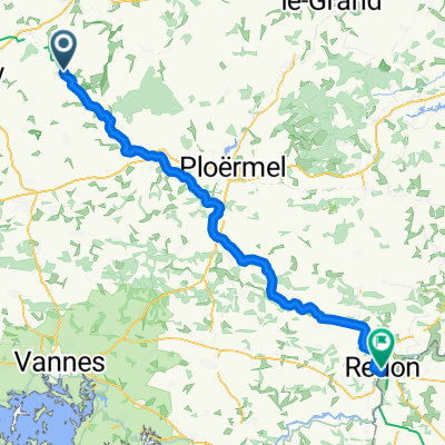
Tag 3
A cycling route starting in Rohan, Brittany Region, France.
Overview
About this route
- -:--
- Duration
- 74.2 km
- Distance
- 479 m
- Ascent
- 383 m
- Descent
- ---
- Avg. speed
- 217 m
- Max. altitude

Route quality
Waytypes & surfaces along the route
Waytypes
Path
49.7 km
(67 %)
Cycleway
12.6 km
(17 %)
Surfaces
Paved
23.7 km
(32 %)
Unpaved
37.8 km
(51 %)
Gravel
37.8 km
(51 %)
Asphalt
23.7 km
(32 %)
Undefined
12.6 km
(17 %)
Continue with Bikemap
Use, edit, or download this cycling route
You would like to ride Tag 3 or customize it for your own trip? Here is what you can do with this Bikemap route:
Free features
- Save this route as favorite or in collections
- Copy & plan your own version of this route
- Sync your route with Garmin or Wahoo
Premium features
Free trial for 3 days, or one-time payment. More about Bikemap Premium.
- Navigate this route on iOS & Android
- Export a GPX / KML file of this route
- Create your custom printout (try it for free)
- Download this route for offline navigation
Discover more Premium features.
Get Bikemap PremiumFrom our community
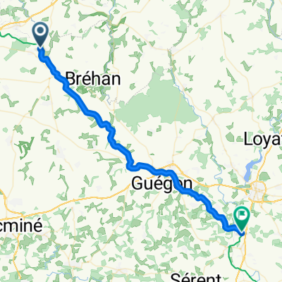
Other popular routes starting in Rohan
 De Rue de Saint-Gouvry à Avenue du Maréchal Foch
- Distance
- 87.2 km
- Ascent
- 413 m
- Descent
- 476 m
- Location
- Rohan, Brittany Region, France
 rohan malestroit
- Distance
- 84.7 km
- Ascent
- 300 m
- Descent
- 332 m
- Location
- Rohan, Brittany Region, France
 De 5–7 Place de l'Église, Rohan à 1–2 Place d'Alzey, Josselin
- Distance
- 25.1 km
- Ascent
- 33 m
- Descent
- 48 m
- Location
- Rohan, Brittany Region, France
 VDYS - Rohan - Pontivy
- Distance
- 24.2 km
- Ascent
- 95 m
- Descent
- 96 m
- Location
- Rohan, Brittany Region, France
 20150411_133123.gpx
- Distance
- 61.3 km
- Ascent
- 380 m
- Descent
- 408 m
- Location
- Rohan, Brittany Region, France
 De Rue de Saint-Gouvry, Rohan à Rue des Tanneurs, Malestroit
- Distance
- 49.6 km
- Ascent
- 187 m
- Descent
- 256 m
- Location
- Rohan, Brittany Region, France
 Rohan to Malestroit
- Distance
- 50 km
- Ascent
- 0 m
- Descent
- 49 m
- Location
- Rohan, Brittany Region, France
 Rohan - Guillac
- Distance
- 43 km
- Ascent
- 193 m
- Descent
- 242 m
- Location
- Rohan, Brittany Region, France
Open it in the app