

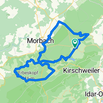
Bruchweiler-Hinzerath-Morbach-Hoxel-Allenbach
A cycling route starting in Bruchweiler, Rhineland-Palatinate, Germany.
Overview
About this route
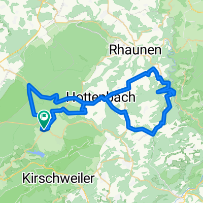
Wir starten in Bruchweiler, fahren nach Schauren; nach ca. 2 km links ab Richtung Hinzerath. In Hinzerath links ab nach Bischofsdhron, weiter nach Morbach über den Bahnübergang. Nach ca. 800 m rechts ab auf asphaltierten Weg, jetzt immer geradeaus bis zur B 269. Hier links ab und ca 2 km auf der B 269 bleiben. Am Abzweig Hoxel rechts ab. in Hoxel dann über Morscheid-Riedenburg nach Deuselbach; jetzt Richtung L 164 halten, auf der L 164 links ab Richtung Erbeskopf ca. 2 km. Dann über Parkplatz aufwärts wieder zur L 164; weiter bis B 269 ( Idarbrücke ). Hier auf den Radweg, der bis Allenbach führt. In Allenbach links ab auf die L 163, die uns wieder zur B 269 führt. Nach ca. 800 m rechts ab auf asphaltierten Weg. Er führt uns nach Langweiler; kurz vor Langweiler links halten, denn wir wollen ja zu dem kleinen Cafe, wo es hervoragenden Kuchen und Kaffee gibt. ( gleich beim Hotel Marienhöh ). Nach dieser Stärkung geht es nach Sensweiler auf die L 162, von hier aus zurück nach Bruchweiler.
1205 Höhenmeter lt. Tour-Explorer Deutschland V 5.
Viel Spass bei der Tour.
- -:--
- Duration
- 57.8 km
- Distance
- 1,043 m
- Ascent
- 1,043 m
- Descent
- ---
- Avg. speed
- ---
- Avg. speed

Route quality
Waytypes & surfaces along the route
Waytypes
Busy road
18.5 km
(32 %)
Road
16.8 km
(29 %)
Surfaces
Paved
49.8 km
(86 %)
Unpaved
4.3 km
(8 %)
Asphalt
47.1 km
(81 %)
Unpaved (undefined)
2.5 km
(4 %)
Continue with Bikemap
Use, edit, or download this cycling route
You would like to ride Bruchweiler-Hinzerath-Morbach-Hoxel-Allenbach or customize it for your own trip? Here is what you can do with this Bikemap route:
Free features
- Save this route as favorite or in collections
- Copy & plan your own version of this route
- Sync your route with Garmin or Wahoo
Premium features
Free trial for 3 days, or one-time payment. More about Bikemap Premium.
- Navigate this route on iOS & Android
- Export a GPX / KML file of this route
- Create your custom printout (try it for free)
- Download this route for offline navigation
Discover more Premium features.
Get Bikemap PremiumFrom our community
Other popular routes starting in Bruchweiler
 Bruchweiler-Hinzerath-Morbach-Hoxel-Allenbach
- Distance
- 57.8 km
- Ascent
- 1,043 m
- Descent
- 1,043 m
- Location
- Bruchweiler, Rhineland-Palatinate, Germany
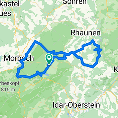 Bruchweiler-Bundenbach-Langweiler
- Distance
- 70.1 km
- Ascent
- 942 m
- Descent
- 942 m
- Location
- Bruchweiler, Rhineland-Palatinate, Germany
 Mosel
Mosel- Distance
- 184.3 km
- Ascent
- 1,097 m
- Descent
- 1,127 m
- Location
- Bruchweiler, Rhineland-Palatinate, Germany
 Recovered Route
- Distance
- 25.3 km
- Ascent
- 243 m
- Descent
- 399 m
- Location
- Bruchweiler, Rhineland-Palatinate, Germany
 Bruchweiler-Hottenbach-Bundenbach
- Distance
- 50.2 km
- Ascent
- 765 m
- Descent
- 765 m
- Location
- Bruchweiler, Rhineland-Palatinate, Germany
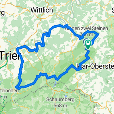
 Bruchweiler-Birkenfeld-Abentheuer
- Distance
- 75.6 km
- Ascent
- 1,119 m
- Descent
- 1,119 m
- Location
- Bruchweiler, Rhineland-Palatinate, Germany
 Bruchweiler-Hottenbach-Bundenbach
- Distance
- 50.2 km
- Ascent
- 774 m
- Descent
- 773 m
- Location
- Bruchweiler, Rhineland-Palatinate, Germany
Open it in the app