

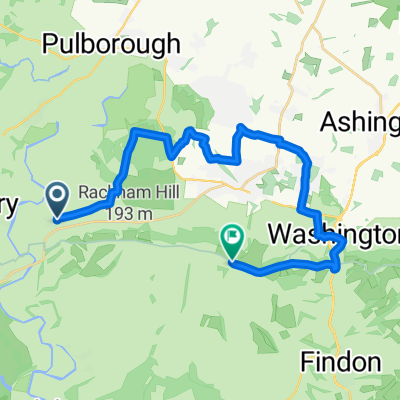
Pulborough Brooks to Woodhatch via Southwater
A cycling route starting in Pulborough, England, United Kingdom.
Overview
About this route
- -:--
- Duration
- 52.7 km
- Distance
- 382 m
- Ascent
- 349 m
- Descent
- ---
- Avg. speed
- 153 m
- Max. altitude

Route quality
Waytypes & surfaces along the route
Waytypes
Road
33.7 km
(64 %)
Quiet road
13.2 km
(25 %)
Surfaces
Paved
23.2 km
(44 %)
Asphalt
23.2 km
(44 %)
Undefined
29.5 km
(56 %)
Continue with Bikemap
Use, edit, or download this cycling route
You would like to ride Pulborough Brooks to Woodhatch via Southwater or customize it for your own trip? Here is what you can do with this Bikemap route:
Free features
- Save this route as favorite or in collections
- Copy & plan your own version of this route
- Sync your route with Garmin or Wahoo
Premium features
Free trial for 3 days, or one-time payment. More about Bikemap Premium.
- Navigate this route on iOS & Android
- Export a GPX / KML file of this route
- Create your custom printout (try it for free)
- Download this route for offline navigation
Discover more Premium features.
Get Bikemap PremiumFrom our community
Other popular routes starting in Pulborough
 Dennis Birthday route
- Distance
- 14.6 km
- Ascent
- 173 m
- Descent
- 173 m
- Location
- Pulborough, England, United Kingdom
 pulborough-arundel saturday
- Distance
- 30.3 km
- Ascent
- 472 m
- Descent
- 484 m
- Location
- Pulborough, England, United Kingdom
 Church Street, Amberley to Arundel loop
- Distance
- 29.5 km
- Ascent
- 607 m
- Descent
- 609 m
- Location
- Pulborough, England, United Kingdom
 Sutton/Bignor
- Distance
- 14.8 km
- Ascent
- 154 m
- Descent
- 140 m
- Location
- Pulborough, England, United Kingdom
 80km downs route
- Distance
- 76.5 km
- Ascent
- 344 m
- Descent
- 347 m
- Location
- Pulborough, England, United Kingdom
 Tuesday bash
- Distance
- 23.3 km
- Ascent
- 167 m
- Descent
- 168 m
- Location
- Pulborough, England, United Kingdom
 Amberley 40
- Distance
- 20.9 km
- Ascent
- 305 m
- Descent
- 130 m
- Location
- Pulborough, England, United Kingdom
 Church Hill to New Barn Road, Amberley
- Distance
- 11.7 km
- Ascent
- 70 m
- Descent
- 74 m
- Location
- Pulborough, England, United Kingdom
Open it in the app