

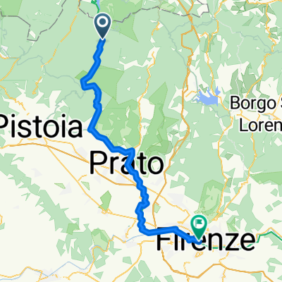
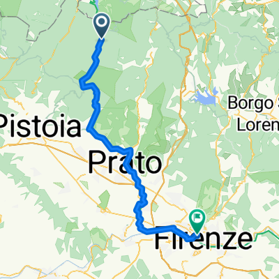
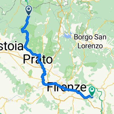
Tabernacolo e Rasa da Santo Stefano
A cycling route starting in Cantagallo, Tuscany, Italy.
Overview
About this route
Alpine climbs right at home. Very tough Fossato from both sides. Rasa is very long clockwise. Terrible asphalt in the final km from Cantagallo to Rasa.
- -:--
- Duration
- 36.2 km
- Distance
- 1,353 m
- Ascent
- 1,353 m
- Descent
- ---
- Avg. speed
- ---
- Max. altitude

Route quality
Waytypes & surfaces along the route
Waytypes
Road
20.3 km
(56 %)
Quiet road
7.6 km
(21 %)
Surfaces
Paved
20.3 km
(56 %)
Unpaved
3.6 km
(10 %)
Asphalt
20.3 km
(56 %)
Loose gravel
2.5 km
(7 %)
Continue with Bikemap
Use, edit, or download this cycling route
You would like to ride Tabernacolo e Rasa da Santo Stefano or customize it for your own trip? Here is what you can do with this Bikemap route:
Free features
- Save this route as favorite or in collections
- Copy & plan your own version of this route
- Sync your route with Garmin or Wahoo
Premium features
Free trial for 3 days, or one-time payment. More about Bikemap Premium.
- Navigate this route on iOS & Android
- Export a GPX / KML file of this route
- Create your custom printout (try it for free)
- Download this route for offline navigation
Discover more Premium features.
Get Bikemap PremiumFrom our community
Other popular routes starting in Cantagallo
 PO BO con aski
- Distance
- 86.4 km
- Ascent
- 226 m
- Descent
- 1,059 m
- Location
- Cantagallo, Tuscany, Italy
 Tabernacolo e Rasa da Santo Stefano
- Distance
- 36.2 km
- Ascent
- 1,353 m
- Descent
- 1,353 m
- Location
- Cantagallo, Tuscany, Italy
 Poggione
- Distance
- 16.1 km
- Ascent
- 368 m
- Descent
- 856 m
- Location
- Cantagallo, Tuscany, Italy
 test
test- Distance
- 91.2 km
- Ascent
- 618 m
- Descent
- 1,376 m
- Location
- Cantagallo, Tuscany, Italy
 Cantagallo - Florenz
- Distance
- 62.3 km
- Ascent
- 957 m
- Descent
- 1,504 m
- Location
- Cantagallo, Tuscany, Italy
 Cantagallo - Firenze
- Distance
- 63.4 km
- Ascent
- 968 m
- Descent
- 1,499 m
- Location
- Cantagallo, Tuscany, Italy
 Cantagallo - Rignano sull'Arno
- Distance
- 78.4 km
- Ascent
- 1,495 m
- Descent
- 1,719 m
- Location
- Cantagallo, Tuscany, Italy
 ACQUERINO-GAVIGNO
- Distance
- 16.3 km
- Ascent
- 554 m
- Descent
- 626 m
- Location
- Cantagallo, Tuscany, Italy
Open it in the app