

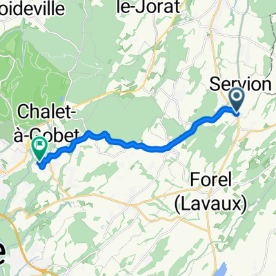
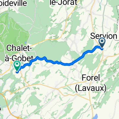
Au Château 3, Oron-le-Châtel nach Grand-Rue 33, Romont
A cycling route starting in Oron-la-Ville, Canton of Vaud, Switzerland.
Overview
About this route
- 2 h 49 min
- Duration
- 30.3 km
- Distance
- 534 m
- Ascent
- 486 m
- Descent
- 10.8 km/h
- Avg. speed
- 930 m
- Max. altitude

Route quality
Waytypes & surfaces along the route
Waytypes
Quiet road
16.1 km
(53 %)
Road
7.9 km
(26 %)
Surfaces
Paved
5.5 km
(18 %)
Unpaved
0.6 km
(2 %)
Asphalt
4.5 km
(15 %)
Paved (undefined)
0.9 km
(3 %)
Continue with Bikemap
Use, edit, or download this cycling route
You would like to ride Au Château 3, Oron-le-Châtel nach Grand-Rue 33, Romont or customize it for your own trip? Here is what you can do with this Bikemap route:
Free features
- Save this route as favorite or in collections
- Copy & plan your own version of this route
- Sync your route with Garmin or Wahoo
Premium features
Free trial for 3 days, or one-time payment. More about Bikemap Premium.
- Navigate this route on iOS & Android
- Export a GPX / KML file of this route
- Create your custom printout (try it for free)
- Download this route for offline navigation
Discover more Premium features.
Get Bikemap PremiumFrom our community
Other popular routes starting in Oron-la-Ville
 Itinéraire facile en
- Distance
- 16.3 km
- Ascent
- 287 m
- Descent
- 288 m
- Location
- Oron-la-Ville, Canton of Vaud, Switzerland
 Chemin du Moléson, Servion à Via Jacobi, Lausanne 26
- Distance
- 9.5 km
- Ascent
- 224 m
- Descent
- 147 m
- Location
- Oron-la-Ville, Canton of Vaud, Switzerland
 route de la maison, Servion
- Distance
- 136.5 km
- Ascent
- 1,834 m
- Descent
- 1,837 m
- Location
- Oron-la-Ville, Canton of Vaud, Switzerland
 Au Château 3, Oron-le-Châtel nach Grand-Rue 33, Romont
- Distance
- 30.3 km
- Ascent
- 534 m
- Descent
- 486 m
- Location
- Oron-la-Ville, Canton of Vaud, Switzerland
 Oron-StMartin route 10
- Distance
- 31.2 km
- Ascent
- 537 m
- Descent
- 537 m
- Location
- Oron-la-Ville, Canton of Vaud, Switzerland
 Chemin du Moléson, Servion à Chemin du Chalet à Matthey, Lausanne 26
- Distance
- 9.3 km
- Ascent
- 228 m
- Descent
- 138 m
- Location
- Oron-la-Ville, Canton of Vaud, Switzerland
 Palezieux/gurnigelpass/thun
- Distance
- 111.6 km
- Ascent
- 2,164 m
- Descent
- 2,240 m
- Location
- Oron-la-Ville, Canton of Vaud, Switzerland
 De Chemin Clos de l'Auberge 3, Servion à Chemin Praz du Perey 1, Servion
- Distance
- 37.8 km
- Ascent
- 142 m
- Descent
- 363 m
- Location
- Oron-la-Ville, Canton of Vaud, Switzerland
Open it in the app