

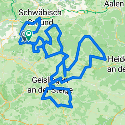
Albextrem2022 260 km
A cycling route starting in Ottenbach, Baden-Wurttemberg, Germany.
Overview
About this route
- -:--
- Duration
- 257.2 km
- Distance
- 4,675 m
- Ascent
- 4,685 m
- Descent
- ---
- Avg. speed
- 818 m
- Max. altitude

Route photos


Route quality
Waytypes & surfaces along the route
Waytypes
Road
110.6 km
(43 %)
Quiet road
28.3 km
(11 %)
Surfaces
Paved
203.2 km
(79 %)
Asphalt
200.6 km
(78 %)
Paved (undefined)
2.6 km
(1 %)
Undefined
54 km
(21 %)
Continue with Bikemap
Use, edit, or download this cycling route
You would like to ride Albextrem2022 260 km or customize it for your own trip? Here is what you can do with this Bikemap route:
Free features
- Save this route as favorite or in collections
- Copy & plan your own version of this route
- Split it into stages to create a multi-day tour
- Sync your route with Garmin or Wahoo
Premium features
Free trial for 3 days, or one-time payment. More about Bikemap Premium.
- Navigate this route on iOS & Android
- Export a GPX / KML file of this route
- Create your custom printout (try it for free)
- Download this route for offline navigation
Discover more Premium features.
Get Bikemap PremiumFrom our community
Other popular routes starting in Ottenbach
 Alb Extrem 210 km
- Distance
- 203 km
- Ascent
- 2,999 m
- Descent
- 2,845 m
- Location
- Ottenbach, Baden-Wurttemberg, Germany
 Albextrem 220 km
- Distance
- 218.2 km
- Ascent
- 3,735 m
- Descent
- 3,579 m
- Location
- Ottenbach, Baden-Wurttemberg, Germany
 Alb Extrem 190
- Distance
- 189.7 km
- Ascent
- 2,899 m
- Descent
- 2,776 m
- Location
- Ottenbach, Baden-Wurttemberg, Germany
 Alb Extrem 2007 - 190 km
- Distance
- 189.2 km
- Ascent
- 2,989 m
- Descent
- 2,852 m
- Location
- Ottenbach, Baden-Wurttemberg, Germany
 Heldenberg über Rehberg
- Distance
- 14.1 km
- Ascent
- 408 m
- Descent
- 228 m
- Location
- Ottenbach, Baden-Wurttemberg, Germany
 Albextrem2022 260 km
- Distance
- 257.2 km
- Ascent
- 4,675 m
- Descent
- 4,685 m
- Location
- Ottenbach, Baden-Wurttemberg, Germany
 Alb Extrem 2008 - 200 km
- Distance
- 195.4 km
- Ascent
- 2,378 m
- Descent
- 2,253 m
- Location
- Ottenbach, Baden-Wurttemberg, Germany
 tour1
tour1- Distance
- 211.6 km
- Ascent
- 3,154 m
- Descent
- 2,990 m
- Location
- Ottenbach, Baden-Wurttemberg, Germany
Open it in the app