Sunday Loop through lancaster County
A cycling route starting in Chester Springs, Pennsylvania, United States.
Overview
About this route
Has two bigger hill climbs with a lot of undulating terrain
- -:--
- Duration
- 86.7 km
- Distance
- 694 m
- Ascent
- 694 m
- Descent
- ---
- Avg. speed
- ---
- Max. altitude
Route quality
Waytypes & surfaces along the route
Waytypes
Busy road
37.5 km
(43 %)
Quiet road
21.9 km
(25 %)
Surfaces
Paved
37.2 km
(43 %)
Asphalt
36.7 km
(42 %)
Concrete
0.5 km
(<1 %)
Undefined
49.5 km
(57 %)
Continue with Bikemap
Use, edit, or download this cycling route
You would like to ride Sunday Loop through lancaster County or customize it for your own trip? Here is what you can do with this Bikemap route:
Free features
- Save this route as favorite or in collections
- Copy & plan your own version of this route
- Split it into stages to create a multi-day tour
- Sync your route with Garmin or Wahoo
Premium features
Free trial for 3 days, or one-time payment. More about Bikemap Premium.
- Navigate this route on iOS & Android
- Export a GPX / KML file of this route
- Create your custom printout (try it for free)
- Download this route for offline navigation
Discover more Premium features.
Get Bikemap PremiumFrom our community
Other popular routes starting in Chester Springs
- Saint Andrews Lane to Saint Andrews Lane
- Distance
- 34.8 km
- Ascent
- 512 m
- Descent
- 471 m
- Location
- Chester Springs, Pennsylvania, United States
- Sunday Loop with three mountain climbs
- Distance
- 93 km
- Ascent
- 713 m
- Descent
- 713 m
- Location
- Chester Springs, Pennsylvania, United States
- Commute to Wrok
- Distance
- 29.9 km
- Ascent
- 229 m
- Descent
- 336 m
- Location
- Chester Springs, Pennsylvania, United States
- Sunday Loop through lancaster County
- Distance
- 86.7 km
- Ascent
- 694 m
- Descent
- 694 m
- Location
- Chester Springs, Pennsylvania, United States
- HybridCycles - Chester Springs Ride
- Distance
- 22.1 km
- Ascent
- 258 m
- Descent
- 261 m
- Location
- Chester Springs, Pennsylvania, United States
- Hill workout in N. Chester and Berks Ctys
- Distance
- 78 km
- Ascent
- 608 m
- Descent
- 612 m
- Location
- Chester Springs, Pennsylvania, United States
- Ride to Work-2 (via Royersford)
- Distance
- 32.2 km
- Ascent
- 292 m
- Descent
- 415 m
- Location
- Chester Springs, Pennsylvania, United States
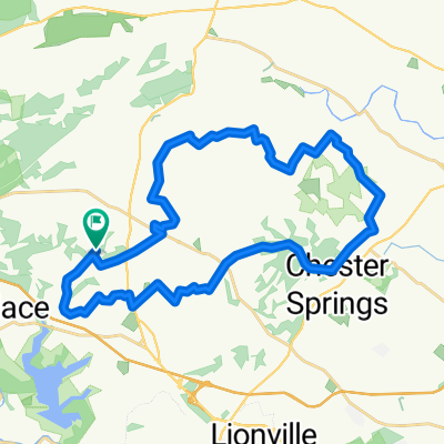
- Moderate route in Chester Springs
- Distance
- 12.1 km
- Ascent
- 123 m
- Descent
- 126 m
- Location
- Chester Springs, Pennsylvania, United States
Open it in the app