

2011_09_25 第二屆 環化賽
A cycling route starting in Chang-hua, Taiwan, Taiwan.
Overview
About this route
- -:--
- Duration
- 107.8 km
- Distance
- 458 m
- Ascent
- 460 m
- Descent
- ---
- Avg. speed
- ---
- Max. altitude
Continue with Bikemap
Use, edit, or download this cycling route
You would like to ride 2011_09_25 第二屆 環化賽 or customize it for your own trip? Here is what you can do with this Bikemap route:
Free features
- Save this route as favorite or in collections
- Copy & plan your own version of this route
- Split it into stages to create a multi-day tour
- Sync your route with Garmin or Wahoo
Premium features
Free trial for 3 days, or one-time payment. More about Bikemap Premium.
- Navigate this route on iOS & Android
- Export a GPX / KML file of this route
- Create your custom printout (try it for free)
- Download this route for offline navigation
Discover more Premium features.
Get Bikemap PremiumFrom our community
Other popular routes starting in Chang-hua
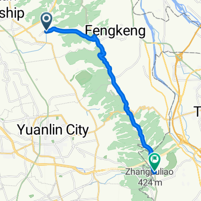
 2011_09_25 第二屆 環化賽
- Distance
- 107.8 km
- Ascent
- 458 m
- Descent
- 460 m
- Location
- Chang-hua, Taiwan, Taiwan
 虎山岩-日月山景
- Distance
- 19.7 km
- Ascent
- 237 m
- Descent
- 232 m
- Location
- Chang-hua, Taiwan, Taiwan
 八卦山休閒路線
- Distance
- 12.9 km
- Ascent
- 178 m
- Descent
- 103 m
- Location
- Chang-hua, Taiwan, Taiwan
 別毛山林道
別毛山林道- Distance
- 126.7 km
- Ascent
- 1,311 m
- Descent
- 1,311 m
- Location
- Chang-hua, Taiwan, Taiwan
 花壇三芬橋到鳳山寺
- Distance
- 14.2 km
- Ascent
- 429 m
- Descent
- 75 m
- Location
- Chang-hua, Taiwan, Taiwan
 2009.4.12 快官~八卦山~賞鷹平臺~楊桃崎~禾家~四面佛O型
- Distance
- 30.2 km
- Ascent
- 572 m
- Descent
- 568 m
- Location
- Chang-hua, Taiwan, Taiwan
 穩定的乘坐 烏日區
- Distance
- 38 km
- Ascent
- 38 m
- Descent
- 69 m
- Location
- Chang-hua, Taiwan, Taiwan
 中彰轉-139 路段 車少空氣好
- Distance
- 35 km
- Ascent
- 452 m
- Descent
- 425 m
- Location
- Chang-hua, Taiwan, Taiwan
Open it in the app