

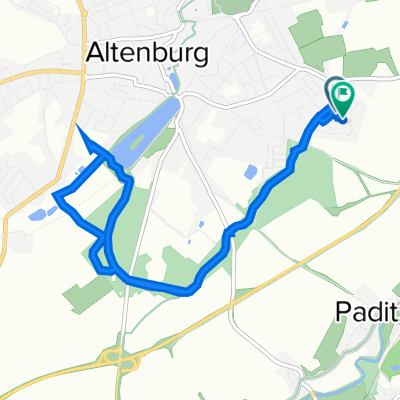
Hermann-Schlegel-Straße 4, Altenburg nach Lange Straße 47, Starkenberg
A cycling route starting in Altenburg, Thuringia, Germany.
Overview
About this route
- 46 min
- Duration
- 10.8 km
- Distance
- 117 m
- Ascent
- 102 m
- Descent
- 14 km/h
- Avg. speed
- 244 m
- Max. altitude

Route quality
Waytypes & surfaces along the route
Waytypes
Road
3.9 km
(36 %)
Track
3.6 km
(33 %)
Surfaces
Paved
6.9 km
(64 %)
Unpaved
0.6 km
(6 %)
Asphalt
6.9 km
(64 %)
Ground
0.5 km
(5 %)
Continue with Bikemap
Use, edit, or download this cycling route
You would like to ride Hermann-Schlegel-Straße 4, Altenburg nach Lange Straße 47, Starkenberg or customize it for your own trip? Here is what you can do with this Bikemap route:
Free features
- Save this route as favorite or in collections
- Copy & plan your own version of this route
- Sync your route with Garmin or Wahoo
Premium features
Free trial for 3 days, or one-time payment. More about Bikemap Premium.
- Navigate this route on iOS & Android
- Export a GPX / KML file of this route
- Create your custom printout (try it for free)
- Download this route for offline navigation
Discover more Premium features.
Get Bikemap PremiumFrom our community
Other popular routes starting in Altenburg
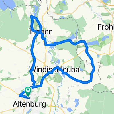
 Grosse Seen Rundfahrt um Altenburg
- Distance
- 75.1 km
- Ascent
- 276 m
- Descent
- 276 m
- Location
- Altenburg, Thuringia, Germany
 Wenzelstraße 43, Altenburg nach Wenzelstraße 43, Altenburg
- Distance
- 44.5 km
- Ascent
- 248 m
- Descent
- 298 m
- Location
- Altenburg, Thuringia, Germany
 Franz-Mehring-Straße 20, Altenburg nach Franz-Mehring-Straße 28, Altenburg
- Distance
- 34.9 km
- Ascent
- 177 m
- Descent
- 216 m
- Location
- Altenburg, Thuringia, Germany
 Altenburg Polsterstein
- Distance
- 59 km
- Ascent
- 401 m
- Descent
- 442 m
- Location
- Altenburg, Thuringia, Germany
 Altenburg Südost - Sternengarten - Märchenbrunnen - zurück
- Distance
- 8.2 km
- Ascent
- 114 m
- Descent
- 112 m
- Location
- Altenburg, Thuringia, Germany
 NightTrail ABG
- Distance
- 19 km
- Ascent
- 226 m
- Descent
- 226 m
- Location
- Altenburg, Thuringia, Germany
 RTF "rund ums Altenburger Land"
- Distance
- 118.1 km
- Ascent
- 726 m
- Descent
- 720 m
- Location
- Altenburg, Thuringia, Germany
 Cosputener See, Pleiße-RW, Altenburg,
- Distance
- 88.1 km
- Ascent
- 171 m
- Descent
- 191 m
- Location
- Altenburg, Thuringia, Germany
Open it in the app