Hündleberg Ostersonntag 2020
- 11 km
- 372 m
- 367 m
- Oberstaufen, Bavaria, Germany
A cycling route starting in Oberstaufen, Bavaria, Germany.
Overview
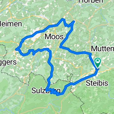
Start is in Thalkirchdorf at the Festsaal; heading towards Schwändle, past the homonymous serviced Alpe. At Moosalpe, turn right and descend towards Buchenegg. In Buchenegg, it goes steeply uphill again towards Hündlekopf, past the chapel. From now on, it's downhill to Thalkirchdorf.
Route quality
Track
7.1 km
(52 %)
Quiet road
3.4 km
(25 %)
Access road
3.2 km
(23 %)
Paved
8.5 km
(62 %)
Unpaved
4.8 km
(35 %)
Asphalt
8.5 km
(62 %)
Loose gravel
3 km
(22 %)
Continue with Bikemap
You would like to ride Um den Hündle or customize it for your own trip? Here is what you can do with this Bikemap route:
Free trial for 3 days, or one-time payment. More about Bikemap Premium.
Discover more Premium features.
Get Bikemap PremiumFrom our community
Open it in the app