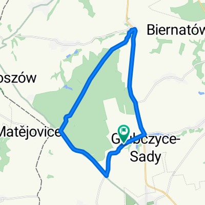
Z Głubczyc przez Czechy (koło)
- 135.7 km
- 1,002 m
- 1,002 m
- Głubczyce, Opole Voivodeship, Poland
Through:
zawiszyce, lisięcice, Ciesznów, Kózki, Gościęcin, Urbanowice, Bytków, Pociękarb, Radziejów, Większyce, Koźle, Port, Januszkowice, Zdzzieszowice, Góra św. Anny, Leśnica, Raszowa, Port, Koźle, Większyce, Analogous return.
By the roads
after Radziejów turn right on [40] - in Koźle ul. Chrobrego - left ul. Piastowska - right ul. Gazowa - right ul. Łukasiewicza - at the traffic lights left ul. Dunikowskiego - behind the bridges left ul. Portowa - right ul. Szymanowskiego - left ul. Kłodnicka [423] - in Zdzieszowice right ul. Chrobrego - left ul. Góra św. Anny near the inn left. Return ul. Góra św. Anny in Lesnica - ul. Koźielska to road [423] in Koźle ul. Kłodnicka right Xawerego Dunikowskiego behind the bridges at the traffic lights right ul. Łukasiewicza - left ul. Piastowska - left ul. Chrobrego [40]
Road
66.8 km64 %Track
10.4 km10 %Paved
37.6 km(36 %)Asphalt
37.6 km36 %Undefined
66.8 km64 %Free trial for 3 days, or one-time payment. More about Bikemap Premium.
Discover more Premium features.
Get Bikemap PremiumOpen it in the app