

Körtúra a Psunj hegységben
A cycling route starting in Cernik, Brodsko-Posavska Županija, Croatia.
Overview
About this route
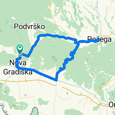
Strmacból induló körtúra a Psunj legmagasabb csúcsára, a 985 méter magas Brezovo polje-ra. A túra második szakasza a Dobra Voda – Crna mlaka – Žakina livada pontok közti nyergen halad végig, majd Cernička Šagovina falunál ér le a hegy lábához. Az utalsó etap ismét a hegy oldalában vezet Šumetlica faluig, majd onnan aszfaltos úton Strmacig.
- -:--
- Duration
- 43.5 km
- Distance
- 1,321 m
- Ascent
- 1,319 m
- Descent
- ---
- Avg. speed
- 990 m
- Avg. speed

Route photos

Route quality
Waytypes & surfaces along the route
Waytypes
Track
33.8 km
(78 %)
Busy road
7.5 km
(17 %)
Surfaces
Paved
5.7 km
(13 %)
Unpaved
32.8 km
(75 %)
Gravel
32.8 km
(75 %)
Asphalt
5.7 km
(13 %)
Undefined
5 km
(11 %)
Continue with Bikemap
Use, edit, or download this cycling route
You would like to ride Körtúra a Psunj hegységben or customize it for your own trip? Here is what you can do with this Bikemap route:
Free features
- Save this route as favorite or in collections
- Copy & plan your own version of this route
- Sync your route with Garmin or Wahoo
Premium features
Free trial for 3 days, or one-time payment. More about Bikemap Premium.
- Navigate this route on iOS & Android
- Export a GPX / KML file of this route
- Create your custom printout (try it for free)
- Download this route for offline navigation
Discover more Premium features.
Get Bikemap PremiumFrom our community
Other popular routes starting in Cernik
 Brezovo polje - clockwise
- Distance
- 44.5 km
- Ascent
- 1,385 m
- Descent
- 1,387 m
- Location
- Cernik, Brodsko-Posavska Županija, Croatia
 maksim test
- Distance
- 70.5 km
- Ascent
- 650 m
- Descent
- 699 m
- Location
- Cernik, Brodsko-Posavska Županija, Croatia
 107. Strmac - Podvrško
- Distance
- 9 km
- Ascent
- 237 m
- Descent
- 274 m
- Location
- Cernik, Brodsko-Posavska Županija, Croatia
 110. Strmac - 2. most - Jastrebinac - Strmac
- Distance
- 15.4 km
- Ascent
- 398 m
- Descent
- 394 m
- Location
- Cernik, Brodsko-Posavska Županija, Croatia
 Cernik (samostan) - Zapolje (župa)
- Distance
- 9.7 km
- Ascent
- 26 m
- Descent
- 64 m
- Location
- Cernik, Brodsko-Posavska Županija, Croatia
 112. Strmac - Velik Gaj - Golobrdac - Podvrško
- Distance
- 18.1 km
- Ascent
- 472 m
- Descent
- 486 m
- Location
- Cernik, Brodsko-Posavska Županija, Croatia
 Körtúra a Psunj hegységben
- Distance
- 43.5 km
- Ascent
- 1,321 m
- Descent
- 1,319 m
- Location
- Cernik, Brodsko-Posavska Županija, Croatia
 Cernik - Brezovo Polje
- Distance
- 44.5 km
- Ascent
- 1,393 m
- Descent
- 1,389 m
- Location
- Cernik, Brodsko-Posavska Županija, Croatia
Open it in the app