

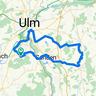
HOLZH PFAFF WEISSENH
- 52.5 km
- 148 m
- 148 m
- Staig, Baden-Wurttemberg, Germany
A cycling route starting in Staig, Baden-Wurttemberg, Germany.
Overview
Route von„9.9767 Ost, 48.3040 Nord“ nach „Höhenstraße, 87629 Füssen“ via „Schloßallee 1, 89257 Illertissen“, „Marktplatz 2, 87727 Babenhausen“, „Erkheimer Straße 10, 87761 Lauben“, „Schlesierstraße 8A, 87671 Ronsberg“, „Bahnhofstraße 36, 87637 Seeg“
created this 56 years ago
Route quality
Road
43.7 km
36 %
Path
7.3 km
6 %
Paved
83.8 km
(69 %)
Asphalt
82.6 km
68 %
Paved (undefined)
1.2 km
1 %
Undefined
37.6 km
31 %
Continue with Bikemap
You would like to ride Hopfensee or customize it for your own trip? Here is what you can do with this Bikemap route:
Free trial for 3 days, or one-time payment. More about Bikemap Premium.
Discover more Premium features.
Get Bikemap PremiumFrom our community
Open it in the app


