

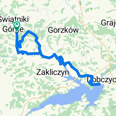
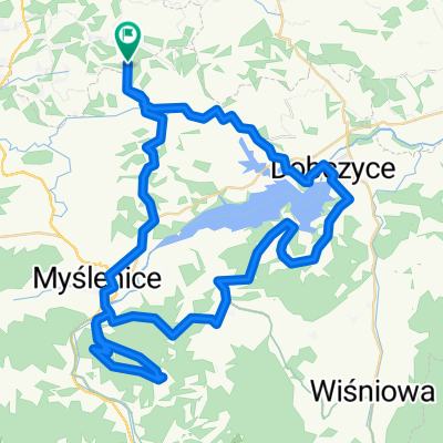
Kazimierza Bruchnalskiego 30, Świątniki Górne do Pod Dębiną 28, Owiątniki Górne
A cycling route starting in Świątniki Górne, Lesser Poland Voivodeship, Poland.
Overview
About this route
- 36 min
- Duration
- 5.8 km
- Distance
- 60 m
- Ascent
- 61 m
- Descent
- 9.7 km/h
- Avg. speed
- 391 m
- Max. altitude
Continue with Bikemap
Use, edit, or download this cycling route
You would like to ride Kazimierza Bruchnalskiego 30, Świątniki Górne do Pod Dębiną 28, Owiątniki Górne or customize it for your own trip? Here is what you can do with this Bikemap route:
Free features
- Save this route as favorite or in collections
- Copy & plan your own version of this route
- Sync your route with Garmin or Wahoo
Premium features
Free trial for 3 days, or one-time payment. More about Bikemap Premium.
- Navigate this route on iOS & Android
- Export a GPX / KML file of this route
- Create your custom printout (try it for free)
- Download this route for offline navigation
Discover more Premium features.
Get Bikemap PremiumFrom our community
Other popular routes starting in Świątniki Górne
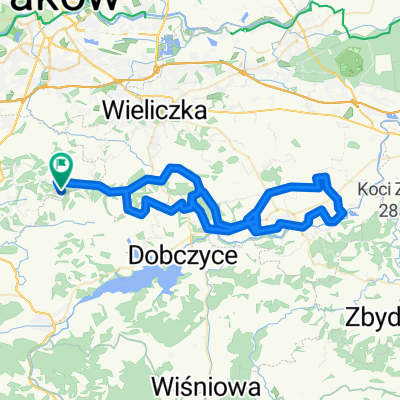 Świętego Stanisława, Świątniki Górne do Świętego Stanisława, Świątniki Górne
- Distance
- 72.5 km
- Ascent
- 895 m
- Descent
- 893 m
- Location
- Świątniki Górne, Lesser Poland Voivodeship, Poland
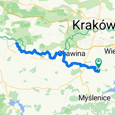
 Świętego Stanisława 61D, Świątniki Górne do Świętego Stanisława 61C, Świątniki Górne
- Distance
- 11.2 km
- Ascent
- 144 m
- Descent
- 142 m
- Location
- Świątniki Górne, Lesser Poland Voivodeship, Poland
 Stage2
- Distance
- 145.5 km
- Ascent
- 1,382 m
- Descent
- 1,436 m
- Location
- Świątniki Górne, Lesser Poland Voivodeship, Poland
 Trasa w Świątniki Górne
- Distance
- 93.4 km
- Ascent
- 723 m
- Descent
- 735 m
- Location
- Świątniki Górne, Lesser Poland Voivodeship, Poland
 Świętego Stanisława, Świątniki Górne do Świętego Stanisława, Świątniki Górne
- Distance
- 87.9 km
- Ascent
- 785 m
- Descent
- 788 m
- Location
- Świątniki Górne, Lesser Poland Voivodeship, Poland
 Świętego Stanisława, Świątniki Górne do Świętego Stanisława, Świątniki Górne
- Distance
- 34.8 km
- Ascent
- 600 m
- Descent
- 600 m
- Location
- Świątniki Górne, Lesser Poland Voivodeship, Poland
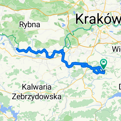
 Olszowice do Podgórska 6, Dobczyce
- Distance
- 16.1 km
- Ascent
- 242 m
- Descent
- 332 m
- Location
- Świątniki Górne, Lesser Poland Voivodeship, Poland
 Route in Świątniki Górne
- Distance
- 66 km
- Ascent
- 1,509 m
- Descent
- 1,515 m
- Location
- Świątniki Górne, Lesser Poland Voivodeship, Poland
Open it in the app