
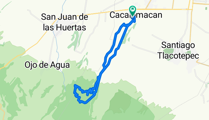
De Miguel Hidalgo 12, Cacalomacán a Miguel Hidalgo 156, Cacalomacán
A cycling route starting in Cacalomacan, State of Mexico, Mexico.
Overview
About this route
- 5 h 10 min
- Duration
- 24.1 km
- Distance
- 569 m
- Ascent
- 570 m
- Descent
- 4.7 km/h
- Avg. speed
- 3,246 m
- Max. altitude

Continue with Bikemap
Use, edit, or download this cycling route
You would like to ride De Miguel Hidalgo 12, Cacalomacán a Miguel Hidalgo 156, Cacalomacán or customize it for your own trip? Here is what you can do with this Bikemap route:
Free features
- Save this route as favorite or in collections
- Copy & plan your own version of this route
- Sync your route with Garmin or Wahoo
Premium features
Free trial for 3 days, or one-time payment. More about Bikemap Premium.
- Navigate this route on iOS & Android
- Export a GPX / KML file of this route
- Create your custom printout (try it for free)
- Download this route for offline navigation
Discover more Premium features.
Get Bikemap PremiumFrom our community
Other popular routes starting in Cacalomacan
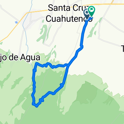
 De Avenida de los Cuervos, Toluca a Calle Águilas, Toluca
- Distance
- 20.3 km
- Ascent
- 862 m
- Descent
- 860 m
- Location
- Cacalomacan, State of Mexico, Mexico
 De Privada Tierra Colorada 63, Cacalomacán a Privada Tierra Colorada 63, Cacalomacán
- Distance
- 38.7 km
- Ascent
- 274 m
- Descent
- 275 m
- Location
- Cacalomacan, State of Mexico, Mexico
 De Miguel Hidalgo 12, Cacalomacán a Miguel Hidalgo 156, Cacalomacán
- Distance
- 24.1 km
- Ascent
- 569 m
- Descent
- 570 m
- Location
- Cacalomacan, State of Mexico, Mexico
 De San Miguel 320, Cacalomacán a Laguna de Los Gigantes 1104, Toluca de Lerdo
- Distance
- 5.2 km
- Ascent
- 0 m
- Descent
- 70 m
- Location
- Cacalomacan, State of Mexico, Mexico
 san juabDe Ignacio Zaragoza a El Nevado
- Distance
- 22.8 km
- Ascent
- 844 m
- Descent
- 852 m
- Location
- Cacalomacan, State of Mexico, Mexico
 De Privada Tierra Colorada 63, Cacalomacán a Privada Tierra Colorada 63, Cacalomacán
- Distance
- 32.5 km
- Ascent
- 389 m
- Descent
- 395 m
- Location
- Cacalomacan, State of Mexico, Mexico
 De De Los Corredores a Circuito Vial Acahualco
- Distance
- 73.6 km
- Ascent
- 1,402 m
- Descent
- 1,393 m
- Location
- Cacalomacan, State of Mexico, Mexico
 Ruta constante en
- Distance
- 2.6 km
- Ascent
- 148 m
- Descent
- 51 m
- Location
- Cacalomacan, State of Mexico, Mexico
Open it in the app