

2021-07 - Mainradweg
2021_07_26 Mainradweg - Tag 1 - Mainspitze-Obernburg
A cycling route starting in Mainz, Rhineland-Palatinate, Germany.
Overview
About this route
null
- -:--
- Duration
- 113.8 km
- Distance
- 377 m
- Ascent
- 330 m
- Descent
- ---
- Avg. speed
- 135 m
- Max. altitude

Part of
2021-07 - Mainradweg
5 stages
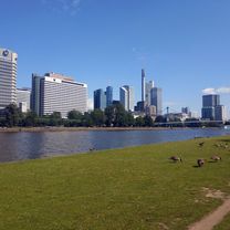
Route photos


Route quality
Waytypes & surfaces along the route
Waytypes
Path
39.8 km
(35 %)
Track
26.2 km
(23 %)
Surfaces
Paved
96.7 km
(85 %)
Unpaved
8 km
(7 %)
Asphalt
93.3 km
(82 %)
Gravel
6.8 km
(6 %)
Continue with Bikemap
Use, edit, or download this cycling route
You would like to ride 2021_07_26 Mainradweg - Tag 1 - Mainspitze-Obernburg or customize it for your own trip? Here is what you can do with this Bikemap route:
Free features
- Save this route as favorite or in collections
- Copy & plan your own version of this route
- Split it into stages to create a multi-day tour
- Sync your route with Garmin or Wahoo
Premium features
Free trial for 3 days, or one-time payment. More about Bikemap Premium.
- Navigate this route on iOS & Android
- Export a GPX / KML file of this route
- Create your custom printout (try it for free)
- Download this route for offline navigation
Discover more Premium features.
Get Bikemap PremiumFrom our community
Other popular routes starting in Mainz
 Feldberg-Runde (direkt & bergig)
- Distance
- 92.7 km
- Ascent
- 1,300 m
- Descent
- 1,302 m
- Location
- Mainz, Rhineland-Palatinate, Germany
 kleine Feierabendrunde II
- Distance
- 33.2 km
- Ascent
- 153 m
- Descent
- 153 m
- Location
- Mainz, Rhineland-Palatinate, Germany
 Kleine Rheinhessenrunde
- Distance
- 28.6 km
- Ascent
- 220 m
- Descent
- 218 m
- Location
- Mainz, Rhineland-Palatinate, Germany
 In alte Gefilde
- Distance
- 50 km
- Ascent
- 365 m
- Descent
- 362 m
- Location
- Mainz, Rhineland-Palatinate, Germany
 kaiser-karl-ring Biebrich
- Distance
- 17.7 km
- Ascent
- 84 m
- Descent
- 86 m
- Location
- Mainz, Rhineland-Palatinate, Germany
 De: Mainz Süd süss
- Distance
- 54.9 km
- Ascent
- 568 m
- Descent
- 555 m
- Location
- Mainz, Rhineland-Palatinate, Germany
 Rheinhessentour um Mainz
- Distance
- 30.6 km
- Ascent
- 278 m
- Descent
- 278 m
- Location
- Mainz, Rhineland-Palatinate, Germany
 20190831 Rheinrunde
- Distance
- 52.5 km
- Ascent
- 82 m
- Descent
- 85 m
- Location
- Mainz, Rhineland-Palatinate, Germany
Open it in the app