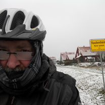
An der Aisch, Bibert, Ehe und Tief
A cycling route starting in Bad Windsheim, Bavaria, Germany.
Overview
About this route
Beautiful route first along the Aisch towards Neustadt. Then the cross connection to Diebach. On the B8 to Langenfeld (alternatively via fields before the railway bridge at Diebach). From Langenfeld into the Ehegrund passing castles and churches, through small farming villages. until Herbolzheim. before Herbolzheim heading towards Ipsheim until shortly before Berolzheim, here there is a moderate incline before Humbrechtsau. Then into the Tiefgrund, past Unterntief to Bad Windsheim. A nice afternoon or early evening tour. Anyone with enough time can also go all the way to Ulsenheim, Seenheim, Ergersheim, Wiebelsheim back to Bad Windsheim about 13 km more.
- -:--
- Duration
- 52 km
- Distance
- 140 m
- Ascent
- 140 m
- Descent
- ---
- Avg. speed
- ---
- Max. altitude
Route quality
Waytypes & surfaces along the route
Waytypes
Track
16.7 km
(32 %)
Road
10.9 km
(21 %)
Surfaces
Paved
29.1 km
(56 %)
Unpaved
0.5 km
(1 %)
Asphalt
22.4 km
(43 %)
Paved (undefined)
4.7 km
(9 %)
Continue with Bikemap
Use, edit, or download this cycling route
You would like to ride An der Aisch, Bibert, Ehe und Tief or customize it for your own trip? Here is what you can do with this Bikemap route:
Free features
- Save this route as favorite or in collections
- Copy & plan your own version of this route
- Sync your route with Garmin or Wahoo
Premium features
Free trial for 3 days, or one-time payment. More about Bikemap Premium.
- Navigate this route on iOS & Android
- Export a GPX / KML file of this route
- Create your custom printout (try it for free)
- Download this route for offline navigation
Discover more Premium features.
Get Bikemap PremiumFrom our community
Other popular routes starting in Bad Windsheim
 2020-09-04 Wiebelsheim - Westheim - Lenkersheim
- Distance
- 23.2 km
- Ascent
- 84 m
- Descent
- 81 m
- Location
- Bad Windsheim, Bavaria, Germany
 2022-03-19 Aischtalradweg Hinweisschilder und Strecke in Ipsheim Fotografiert
- Distance
- 33.9 km
- Ascent
- 86 m
- Descent
- 87 m
- Location
- Bad Windsheim, Bavaria, Germany
 2023-04-30 Zu den Gottesdiensten in Rüdisbronn und Kaubenheim
- Distance
- 24 km
- Ascent
- 93 m
- Descent
- 93 m
- Location
- Bad Windsheim, Bavaria, Germany
 2020-09-03
- Distance
- 25.1 km
- Ascent
- 74 m
- Descent
- 73 m
- Location
- Bad Windsheim, Bavaria, Germany
 2020-10-11 zu den Weinbergen in Ipsheim
- Distance
- 23.4 km
- Ascent
- 81 m
- Descent
- 80 m
- Location
- Bad Windsheim, Bavaria, Germany
 2020-12-10 Kleine Winterrunde
- Distance
- 21.8 km
- Ascent
- 58 m
- Descent
- 57 m
- Location
- Bad Windsheim, Bavaria, Germany
 ride through Bad Windsheim
- Distance
- 12.5 km
- Ascent
- 26 m
- Descent
- 30 m
- Location
- Bad Windsheim, Bavaria, Germany
 2020-09-23 Nach Hasenlohe
- Distance
- 38.7 km
- Ascent
- 133 m
- Descent
- 133 m
- Location
- Bad Windsheim, Bavaria, Germany
Open it in the app


