

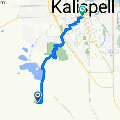
Kalispell - Somers
A cycling route starting in Kalispell, Montana, United States.
Overview
About this route
- -:--
- Duration
- 31.2 km
- Distance
- 68 m
- Ascent
- 68 m
- Descent
- ---
- Avg. speed
- ---
- Max. altitude

Continue with Bikemap
Use, edit, or download this cycling route
You would like to ride Kalispell - Somers or customize it for your own trip? Here is what you can do with this Bikemap route:
Free features
- Save this route as favorite or in collections
- Copy & plan your own version of this route
- Sync your route with Garmin or Wahoo
Premium features
Free trial for 3 days, or one-time payment. More about Bikemap Premium.
- Navigate this route on iOS & Android
- Export a GPX / KML file of this route
- Create your custom printout (try it for free)
- Download this route for offline navigation
Discover more Premium features.
Get Bikemap PremiumFrom our community
Other popular routes starting in Kalispell
 Smith Lake
- Distance
- 13.3 km
- Ascent
- 50 m
- Descent
- 26 m
- Location
- Kalispell, Montana, United States
 Foys Lake Road to South Main Street
- Distance
- 9.7 km
- Ascent
- 157 m
- Descent
- 299 m
- Location
- Kalispell, Montana, United States
 Haskill Mountain
- Distance
- 43.8 km
- Ascent
- 1,084 m
- Descent
- 143 m
- Location
- Kalispell, Montana, United States
 1305 US Highway 2 W, Kalispell to 2449 US Highway 2 W, Kalispell
- Distance
- 6.3 km
- Ascent
- 392 m
- Descent
- 344 m
- Location
- Kalispell, Montana, United States
 Kalispell - Somers
- Distance
- 31.2 km
- Ascent
- 68 m
- Descent
- 68 m
- Location
- Kalispell, Montana, United States
 Summer Roadtrip_Kalispell to Whitefish
- Distance
- 26 km
- Ascent
- 110 m
- Descent
- 86 m
- Location
- Kalispell, Montana, United States
 Hwy 93 to Lower Valley
- Distance
- 33.8 km
- Ascent
- 53 m
- Descent
- 54 m
- Location
- Kalispell, Montana, United States
 Spring Creek - Fox Farm - KM Ranch - Whitefish
- Distance
- 68.8 km
- Ascent
- 321 m
- Descent
- 321 m
- Location
- Kalispell, Montana, United States
Open it in the app