

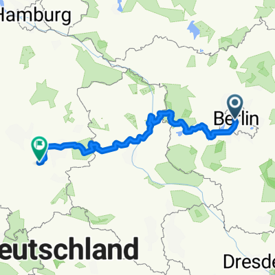
Velothon 2009
A cycling route starting in Tiergarten, State of Berlin, Germany.
Overview
About this route
- -:--
- Duration
- 122.7 km
- Distance
- 272 m
- Ascent
- 274 m
- Descent
- ---
- Avg. speed
- 70 m
- Max. altitude
Route quality
Waytypes & surfaces along the route
Waytypes
Road
40.5 km
(33 %)
Path
11 km
(9 %)
Surfaces
Paved
109.2 km
(89 %)
Unpaved
2.5 km
(2 %)
Asphalt
108 km
(88 %)
Ground
2.5 km
(2 %)
Route highlights
Points of interest along the route
Point of interest after 122.2 km
Continue with Bikemap
Use, edit, or download this cycling route
You would like to ride Velothon 2009 or customize it for your own trip? Here is what you can do with this Bikemap route:
Free features
- Save this route as favorite or in collections
- Copy & plan your own version of this route
- Split it into stages to create a multi-day tour
- Sync your route with Garmin or Wahoo
Premium features
Free trial for 3 days, or one-time payment. More about Bikemap Premium.
- Navigate this route on iOS & Android
- Export a GPX / KML file of this route
- Create your custom printout (try it for free)
- Download this route for offline navigation
Discover more Premium features.
Get Bikemap PremiumFrom our community
Other popular routes starting in Tiergarten
 From Berlin to Beetzsee
- Distance
- 428.1 km
- Ascent
- 1,720 m
- Descent
- 1,626 m
- Location
- Tiergarten, State of Berlin, Germany
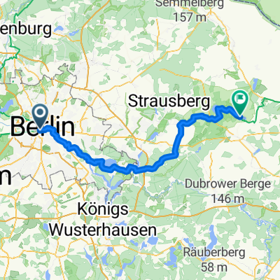
 Seddiner See
- Distance
- 115.4 km
- Ascent
- 229 m
- Descent
- 229 m
- Location
- Tiergarten, State of Berlin, Germany
 Skoda Velothon 2011 60km
- Distance
- 63.9 km
- Ascent
- 0 m
- Descent
- 0 m
- Location
- Tiergarten, State of Berlin, Germany
 2021 Spreewald Tag 7: Radrundtour Berlin, 16 km
- Distance
- 15.6 km
- Ascent
- 75 m
- Descent
- 72 m
- Location
- Tiergarten, State of Berlin, Germany
 Tiergarten - Müncheberg
- Distance
- 79.8 km
- Ascent
- 18 m
- Descent
- 4 m
- Location
- Tiergarten, State of Berlin, Germany
 Berlin to Finsterwalde
- Distance
- 113.6 km
- Ascent
- 232 m
- Descent
- 160 m
- Location
- Tiergarten, State of Berlin, Germany
 Begleitung ERT 2008
- Distance
- 148.2 km
- Ascent
- 358 m
- Descent
- 350 m
- Location
- Tiergarten, State of Berlin, Germany
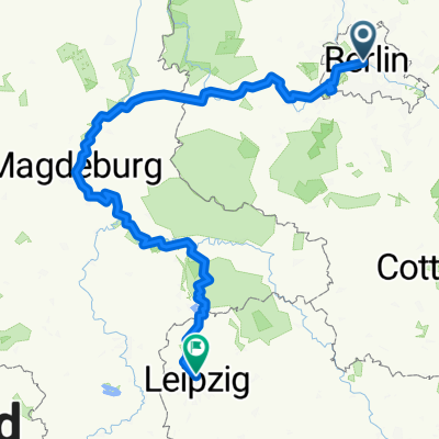 Von Berlin bis Leipzig
- Distance
- 364.5 km
- Ascent
- 1,140 m
- Descent
- 1,041 m
- Location
- Tiergarten, State of Berlin, Germany
Open it in the app