

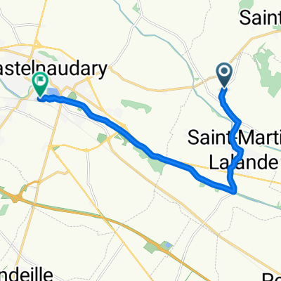
Tappa 9 FaunTour2k22
A cycling route starting in Saint-Martin-Lalande, Occitanie, France.
Overview
About this route
- -:--
- Duration
- 105.7 km
- Distance
- 258 m
- Ascent
- 294 m
- Descent
- ---
- Avg. speed
- 196 m
- Max. altitude

Route quality
Waytypes & surfaces along the route
Waytypes
Path
44.4 km
(42 %)
Cycleway
33.8 km
(32 %)
Surfaces
Paved
86.7 km
(82 %)
Unpaved
16.9 km
(16 %)
Asphalt
85.6 km
(81 %)
Ground
8.5 km
(8 %)
Continue with Bikemap
Use, edit, or download this cycling route
You would like to ride Tappa 9 FaunTour2k22 or customize it for your own trip? Here is what you can do with this Bikemap route:
Free features
- Save this route as favorite or in collections
- Copy & plan your own version of this route
- Split it into stages to create a multi-day tour
- Sync your route with Garmin or Wahoo
Premium features
Free trial for 3 days, or one-time payment. More about Bikemap Premium.
- Navigate this route on iOS & Android
- Export a GPX / KML file of this route
- Create your custom printout (try it for free)
- Download this route for offline navigation
Discover more Premium features.
Get Bikemap PremiumFrom our community
Other popular routes starting in Saint-Martin-Lalande
 Domaine de la Capelle, Saint-Martin-Lalande to Place de la Gare, Castelnaudary
- Distance
- 9.6 km
- Ascent
- 67 m
- Descent
- 64 m
- Location
- Saint-Martin-Lalande, Occitanie, France
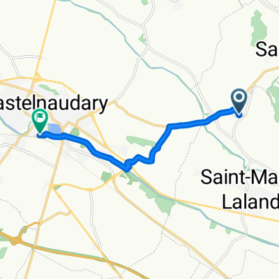
 Domaine de la Capelle, Saint-Martin-Lalande to Trèbes
- Distance
- 52.8 km
- Ascent
- 147 m
- Descent
- 221 m
- Location
- Saint-Martin-Lalande, Occitanie, France
 De Rue de l'Horloge 3, Pexiora à Avenue de Toulouse 11, Alzonne
- Distance
- 13 km
- Ascent
- 56 m
- Descent
- 72 m
- Location
- Saint-Martin-Lalande, Occitanie, France
 Castelnaudary LampyNeuf
- Distance
- 53 km
- Ascent
- 794 m
- Descent
- 776 m
- Location
- Saint-Martin-Lalande, Occitanie, France
 Tappa 9 FaunTour2k22
- Distance
- 105.7 km
- Ascent
- 258 m
- Descent
- 294 m
- Location
- Saint-Martin-Lalande, Occitanie, France
 Domaine de la Capelle, Saint-Martin-Lalande to Place de la Gare, Castelnaudary
- Distance
- 6.9 km
- Ascent
- 60 m
- Descent
- 57 m
- Location
- Saint-Martin-Lalande, Occitanie, France
 14 Apr 2015 11:34
- Distance
- 2.6 km
- Ascent
- 56 m
- Descent
- 48 m
- Location
- Saint-Martin-Lalande, Occitanie, France
 14_Sarrazi Toulouse
- Distance
- 74.2 km
- Ascent
- 265 m
- Descent
- 278 m
- Location
- Saint-Martin-Lalande, Occitanie, France
Open it in the app