

琵琶湖 南湖一周
A cycling route starting in Kusatsu, Shiga Prefecture, Japan.
Overview
About this route
- 3 h 49 min
- Duration
- 57.9 km
- Distance
- 105 m
- Ascent
- 106 m
- Descent
- 15.2 km/h
- Avg. speed
- 97 m
- Max. altitude

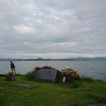
Route photos


Route quality
Waytypes & surfaces along the route
Waytypes
Cycleway
15.6 km
(27 %)
Quiet road
9.8 km
(17 %)
Surfaces
Paved
24.3 km
(42 %)
Paved (undefined)
15.6 km
(27 %)
Asphalt
8.7 km
(15 %)
Undefined
33.6 km
(58 %)
Continue with Bikemap
Use, edit, or download this cycling route
You would like to ride 琵琶湖 南湖一周 or customize it for your own trip? Here is what you can do with this Bikemap route:
Free features
- Save this route as favorite or in collections
- Copy & plan your own version of this route
- Sync your route with Garmin or Wahoo
Premium features
Free trial for 3 days, or one-time payment. More about Bikemap Premium.
- Navigate this route on iOS & Android
- Export a GPX / KML file of this route
- Create your custom printout (try it for free)
- Download this route for offline navigation
Discover more Premium features.
Get Bikemap PremiumFrom our community
Other popular routes starting in Kusatsu
 琵琶湖 南湖一周
- Distance
- 57.9 km
- Ascent
- 105 m
- Descent
- 106 m
- Location
- Kusatsu, Shiga Prefecture, Japan
 ビワイチ1(草津-彦根城-龍潭寺-長浜)
- Distance
- 67.9 km
- Ascent
- 71 m
- Descent
- 79 m
- Location
- Kusatsu, Shiga Prefecture, Japan
 20230616川重冷熱 日進寮, 草津市 まで守山市
- Distance
- 12.2 km
- Ascent
- 0 m
- Descent
- 56 m
- Location
- Kusatsu, Shiga Prefecture, Japan
 Lake Biwa Nov 20
- Distance
- 76.6 km
- Ascent
- 39 m
- Descent
- 56 m
- Location
- Kusatsu, Shiga Prefecture, Japan
 Moderate route
- Distance
- 14.5 km
- Ascent
- 0 m
- Descent
- 3 m
- Location
- Kusatsu, Shiga Prefecture, Japan
 four seasons
- Distance
- 25.4 km
- Ascent
- 243 m
- Descent
- 305 m
- Location
- Kusatsu, Shiga Prefecture, Japan
 Day 9 - Kusatu to Osaka
- Distance
- 70.8 km
- Ascent
- 171 m
- Descent
- 247 m
- Location
- Kusatsu, Shiga Prefecture, Japan
 Tour du Japon - Jour 37 Moriyama - Kyoto/Osaka
- Distance
- 31.5 km
- Ascent
- 239 m
- Descent
- 294 m
- Location
- Kusatsu, Shiga Prefecture, Japan
Open it in the app