333 S Davis St, Telluride to 301–699 N Trout Lake Rd, Ophir
A cycling route starting in Telluride, Colorado, United States of America.
Overview
About this route
- 1 h 52 min
- Duration
- 22.8 km
- Distance
- 701 m
- Ascent
- 408 m
- Descent
- 12.2 km/h
- Avg. speed
- 2,987 m
- Avg. speed
Route quality
Waytypes & surfaces along the route
Waytypes
Busy road
20.6 km
(90 %)
Quiet road
1.5 km
(7 %)
Cycleway
0.7 km
(3 %)
Surfaces
Paved
21.4 km
(94 %)
Unpaved
1.3 km
(6 %)
Asphalt
20.5 km
(90 %)
Unpaved (undefined)
1.1 km
(5 %)
Continue with Bikemap
Use, edit, or download this cycling route
You would like to ride 333 S Davis St, Telluride to 301–699 N Trout Lake Rd, Ophir or customize it for your own trip? Here is what you can do with this Bikemap route:
Free features
- Save this route as favorite or in collections
- Copy & plan your own version of this route
- Sync your route with Garmin or Wahoo
Premium features
Free trial for 3 days, or one-time payment. More about Bikemap Premium.
- Navigate this route on iOS & Android
- Export a GPX / KML file of this route
- Create your custom printout (try it for free)
- Download this route for offline navigation
Discover more Premium features.
Get Bikemap PremiumFrom our community
Other popular routes starting in Telluride
- Day 1: Alt. Galloping Goose sanjuanhuts
- Distance
- 29.9 km
- Ascent
- 1,054 m
- Descent
- 395 m
- Location
- Telluride, Colorado, United States of America
- 37.938° N -107.818° W to 37.965° N -107.906° W
- Distance
- 11.2 km
- Ascent
- 277 m
- Descent
- 214 m
- Location
- Telluride, Colorado, United States of America
- 28alt
- Distance
- 18.9 km
- Ascent
- 573 m
- Descent
- 1,271 m
- Location
- Telluride, Colorado, United States of America
- 333 S Davis St, Telluride to 301–699 N Trout Lake Rd, Ophir
- Distance
- 22.8 km
- Ascent
- 701 m
- Descent
- 408 m
- Location
- Telluride, Colorado, United States of America
- 2016 Bike Tour Day 2: Telluride to Rico
- Distance
- 44.7 km
- Ascent
- 759 m
- Descent
- 756 m
- Location
- Telluride, Colorado, United States of America
- Telluride-Mountain Village
- Distance
- 12.2 km
- Ascent
- 324 m
- Descent
- 97 m
- Location
- Telluride, Colorado, United States of America
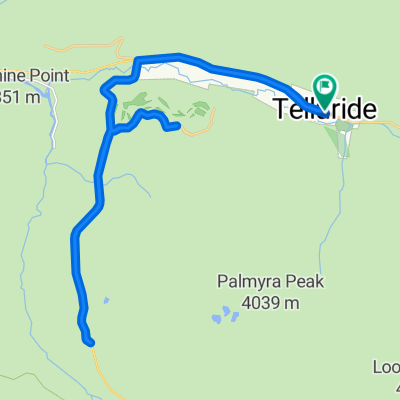
- 066.Pandora-Cortez_130
- Distance
- 130.2 km
- Ascent
- 747 m
- Descent
- 1,594 m
- Location
- Telluride, Colorado, United States of America
- airport morning ride
- Distance
- 22.3 km
- Ascent
- 436 m
- Descent
- 437 m
- Location
- Telluride, Colorado, United States of America
Open it in the app