

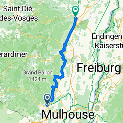
Tour France_Vosges_ Belfort - Cernay
A cycling route starting in Cernay, Grand Est, France.
Overview
About this route
- -:--
- Duration
- 195.2 km
- Distance
- 3,956 m
- Ascent
- 3,887 m
- Descent
- ---
- Avg. speed
- ---
- Max. altitude

Route highlights
Points of interest along the route
Point of interest after 24.1 km
Grand Ballon 1343m Par Saint Amarin 119 Par Moosch 113
Point of interest after 46.3 km
Petit Drumond 1150 par Urbès 84
Point of interest after 64.6 km
Le Markstein 1190m par Guebwiller 75
Point of interest after 69 km
Col du Platzerwasel 1183m par Munster 83
Point of interest after 89.6 km
Le Pettit Ballon 1163m Par Wihr au Val ou Munster 90
Point of interest after 100.7 km
Point of interest after 107.5 km
Le Champ du Feu 1100m Par Villé 84
Point of interest after 107.5 km
Col du Calvaire 1144m par Munster 83
Point of interest after 120.1 km
Col de la Schlucht
Point of interest after 162.4 km
Col de Bussang
Point of interest after 170.5 km
Ballon d`Alsace 1171m par Saint Maurice sur Moselle 70
Continue with Bikemap
Use, edit, or download this cycling route
You would like to ride Tour France_Vosges_ Belfort - Cernay or customize it for your own trip? Here is what you can do with this Bikemap route:
Free features
- Save this route as favorite or in collections
- Copy & plan your own version of this route
- Split it into stages to create a multi-day tour
- Sync your route with Garmin or Wahoo
Premium features
Free trial for 3 days, or one-time payment. More about Bikemap Premium.
- Navigate this route on iOS & Android
- Export a GPX / KML file of this route
- Create your custom printout (try it for free)
- Download this route for offline navigation
Discover more Premium features.
Get Bikemap PremiumFrom our community
Other popular routes starting in Cernay
 FR1-15_Uffholtz - Chatenois_76,0km 320hm
- Distance
- 80.6 km
- Ascent
- 356 m
- Descent
- 464 m
- Location
- Cernay, Grand Est, France
 Routes des Cretes
- Distance
- 103.7 km
- Ascent
- 2,667 m
- Descent
- 2,765 m
- Location
- Cernay, Grand Est, France
 3.Mai Route des Cretes
- Distance
- 114.4 km
- Ascent
- 3,028 m
- Descent
- 3,154 m
- Location
- Cernay, Grand Est, France
 2019 5.Tag RG Nagoldtal
- Distance
- 129.3 km
- Ascent
- 1,939 m
- Descent
- 1,942 m
- Location
- Cernay, Grand Est, France
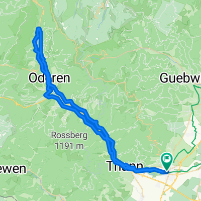
 Cernay - Thann - Wildenstein - Markstein - Grand Ballon - Cernay
- Distance
- 102.2 km
- Ascent
- 1,495 m
- Descent
- 1,493 m
- Location
- Cernay, Grand Est, France
 Cernay - Vallée de la Thur - Lac de Wildenstein
- Distance
- 61.6 km
- Ascent
- 375 m
- Descent
- 375 m
- Location
- Cernay, Grand Est, France
 Tour France_Vosges_ Belfort - Cernay
- Distance
- 195.2 km
- Ascent
- 3,956 m
- Descent
- 3,887 m
- Location
- Cernay, Grand Est, France
 grand ballon
- Distance
- 23.6 km
- Ascent
- 1,232 m
- Descent
- 214 m
- Location
- Cernay, Grand Est, France
Open it in the app