Holland Belgien gesamte Strecke
A cycling route starting in Sint Anthonis, North Brabant, Netherlands.
Overview
About this route
- 30 h 30 min
- Duration
- 521.6 km
- Distance
- 536 m
- Ascent
- 533 m
- Descent
- 17.1 km/h
- Avg. speed
- 50 m
- Avg. speed
Route quality
Waytypes & surfaces along the route
Waytypes
Cycleway
257.5 km
(49 %)
Quiet road
141.8 km
(27 %)
Surfaces
Paved
332.5 km
(64 %)
Unpaved
5 km
(<1 %)
Asphalt
242.9 km
(47 %)
Concrete
37.9 km
(7 %)
Continue with Bikemap
Use, edit, or download this cycling route
You would like to ride Holland Belgien gesamte Strecke or customize it for your own trip? Here is what you can do with this Bikemap route:
Free features
- Save this route as favorite or in collections
- Copy & plan your own version of this route
- Split it into stages to create a multi-day tour
- Sync your route with Garmin or Wahoo
Premium features
Free trial for 3 days, or one-time payment. More about Bikemap Premium.
- Navigate this route on iOS & Android
- Export a GPX / KML file of this route
- Create your custom printout (try it for free)
- Download this route for offline navigation
Discover more Premium features.
Get Bikemap PremiumFrom our community
Other popular routes starting in Sint Anthonis
- TKO Route 3 Gennep - Afferden - Well
- Distance
- 71.9 km
- Ascent
- 75 m
- Descent
- 74 m
- Location
- Sint Anthonis, North Brabant, Netherlands
- Oploo - Speklef
- Distance
- 6.5 km
- Ascent
- 0 m
- Descent
- 0 m
- Location
- Sint Anthonis, North Brabant, Netherlands
- 1 Sint Anthonis - Opijnen
- Distance
- 65.5 km
- Ascent
- 87 m
- Descent
- 99 m
- Location
- Sint Anthonis, North Brabant, Netherlands
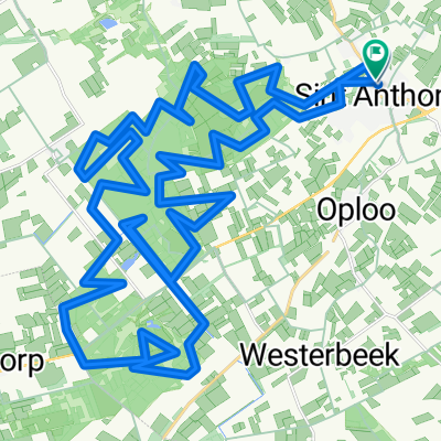
- Jutta van Nassaulaan 12, Sint Anthonis naar Breestraat 1D, Sint Anthonis
- Distance
- 51.1 km
- Ascent
- 1,353 m
- Descent
- 1,349 m
- Location
- Sint Anthonis, North Brabant, Netherlands
- Sint Anthonisbos|trackspotting.com
- Distance
- 11.6 km
- Ascent
- 38 m
- Descent
- 40 m
- Location
- Sint Anthonis, North Brabant, Netherlands
- Watertappuntenroute Sint Anthonis 50 km
- Distance
- 50.1 km
- Ascent
- 29 m
- Descent
- 32 m
- Location
- Sint Anthonis, North Brabant, Netherlands
- Bea - Wendy 25KM Route
- Distance
- 24.5 km
- Ascent
- 29 m
- Descent
- 26 m
- Location
- Sint Anthonis, North Brabant, Netherlands
- Land van Cuijk 54 km
- Distance
- 53.8 km
- Ascent
- 52 m
- Descent
- 54 m
- Location
- Sint Anthonis, North Brabant, Netherlands
Open it in the app