

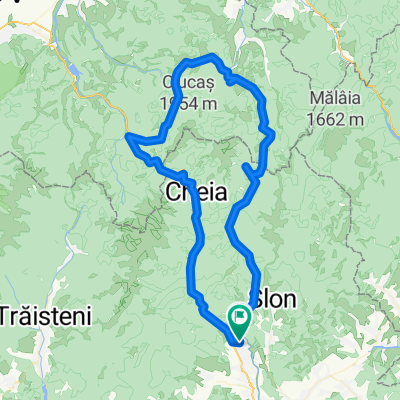
eMTB Maneciu-Slon-Tabla Butii-Cascada Schinda
A cycling route starting in Măneciu-Ungureni, Prahova, Romania.
Overview
About this route
- 6 h 56 min
- Duration
- 55.7 km
- Distance
- 1,669 m
- Ascent
- 1,655 m
- Descent
- 8 km/h
- Avg. speed
- 1,468 m
- Max. altitude

Route photos


Route quality
Waytypes & surfaces along the route
Waytypes
Quiet road
27 km
(48 %)
Track
25.4 km
(46 %)
Surfaces
Paved
6.2 km
(11 %)
Unpaved
45.5 km
(82 %)
Loose gravel
21.7 km
(39 %)
Ground
19.9 km
(36 %)
Continue with Bikemap
Use, edit, or download this cycling route
You would like to ride eMTB Maneciu-Slon-Tabla Butii-Cascada Schinda or customize it for your own trip? Here is what you can do with this Bikemap route:
Free features
- Save this route as favorite or in collections
- Copy & plan your own version of this route
- Sync your route with Garmin or Wahoo
Premium features
Free trial for 3 days, or one-time payment. More about Bikemap Premium.
- Navigate this route on iOS & Android
- Export a GPX / KML file of this route
- Create your custom printout (try it for free)
- Download this route for offline navigation
Discover more Premium features.
Get Bikemap PremiumFrom our community
Other popular routes starting in Măneciu-Ungureni
 Tabla Butii
- Distance
- 47.7 km
- Ascent
- 1,120 m
- Descent
- 1,120 m
- Location
- Măneciu-Ungureni, Prahova, Romania
 Muntii Tataru - Vf. lui Crai
- Distance
- 49.2 km
- Ascent
- 1,076 m
- Descent
- 1,076 m
- Location
- Măneciu-Ungureni, Prahova, Romania
 Maneciu-lacul Vulturilor-Crasna
- Distance
- 50.1 km
- Ascent
- 1,302 m
- Descent
- 1,209 m
- Location
- Măneciu-Ungureni, Prahova, Romania
 Cheia MTB Challenge 2014
- Distance
- 49.8 km
- Ascent
- 1,121 m
- Descent
- 1,121 m
- Location
- Măneciu-Ungureni, Prahova, Romania
 Traseul Muntilor Tataru
- Distance
- 47.6 km
- Ascent
- 1,168 m
- Descent
- 926 m
- Location
- Măneciu-Ungureni, Prahova, Romania
 eMTB Maneciu-Slon-Tabla Butii-Cascada Schinda
- Distance
- 55.7 km
- Ascent
- 1,669 m
- Descent
- 1,655 m
- Location
- Măneciu-Ungureni, Prahova, Romania
 Tura Ocolul Ciucasului
- Distance
- 97.1 km
- Ascent
- 1,628 m
- Descent
- 1,626 m
- Location
- Măneciu-Ungureni, Prahova, Romania
 Creasta Muntilor Tataru
- Distance
- 49.1 km
- Ascent
- 1,095 m
- Descent
- 1,090 m
- Location
- Măneciu-Ungureni, Prahova, Romania
Open it in the app