

Noves-Gault-Noves
A cycling route starting in Saint-Andiol, Provence-Alpes-Côte d'Azur Region, France.
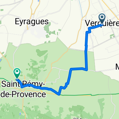
Overview
About this route
- -:--
- Duration
- 74.1 km
- Distance
- 272 m
- Ascent
- 274 m
- Descent
- ---
- Avg. speed
- ---
- Max. altitude
Route highlights
Points of interest along the route
Point of interest after 74.1 km
Continue with Bikemap
Use, edit, or download this cycling route
You would like to ride Noves-Gault-Noves or customize it for your own trip? Here is what you can do with this Bikemap route:
Free features
- Save this route as favorite or in collections
- Copy & plan your own version of this route
- Sync your route with Garmin or Wahoo
Premium features
Free trial for 3 days, or one-time payment. More about Bikemap Premium.
- Navigate this route on iOS & Android
- Export a GPX / KML file of this route
- Create your custom printout (try it for free)
- Download this route for offline navigation
Discover more Premium features.
Get Bikemap PremiumFrom our community
Other popular routes starting in Saint-Andiol
 11 Lotissement Les Sarcelles, Saint-Andiol to 11 Lotissement Les Sarcelles, Saint-Andiol
- Distance
- 43.3 km
- Ascent
- 168 m
- Descent
- 165 m
- Location
- Saint-Andiol, Provence-Alpes-Côte d'Azur Region, France
 20220908_Saint-Andiol-Roussillon
- Distance
- 35.4 km
- Ascent
- 457 m
- Descent
- 214 m
- Location
- Saint-Andiol, Provence-Alpes-Côte d'Azur Region, France
 Place de l'Église nach Chemin Monplaisir
- Distance
- 14 km
- Ascent
- 81 m
- Descent
- 142 m
- Location
- Saint-Andiol, Provence-Alpes-Côte d'Azur Region, France
 Alpilles Tour 80
- Distance
- 80.9 km
- Ascent
- 252 m
- Descent
- 252 m
- Location
- Saint-Andiol, Provence-Alpes-Côte d'Azur Region, France
 371–759 Route de St-Sauveur, Saint-Andiol à 22 Lotissement les Muscadelles, Saint-Andiol
- Distance
- 45.7 km
- Ascent
- 97 m
- Descent
- 99 m
- Location
- Saint-Andiol, Provence-Alpes-Côte d'Azur Region, France
 Noves-Gault-Noves
- Distance
- 74.1 km
- Ascent
- 272 m
- Descent
- 274 m
- Location
- Saint-Andiol, Provence-Alpes-Côte d'Azur Region, France
 GravNord2_70
- Distance
- 66.9 km
- Ascent
- 239 m
- Descent
- 237 m
- Location
- Saint-Andiol, Provence-Alpes-Côte d'Azur Region, France
 Arrival Day - Saint Andion to Concuran - 55 kms
- Distance
- 54.1 km
- Ascent
- 547 m
- Descent
- 264 m
- Location
- Saint-Andiol, Provence-Alpes-Côte d'Azur Region, France
Open it in the app