

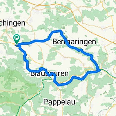
Halbschatten Tour
A cycling route starting in Berghülen, Baden-Wurttemberg, Germany.
Overview
About this route
Very pleasant tour :
- Lots of forest air
- Good balance between climbs and descents
- 60 % gravel, 30 % asphalt, 10 % coarse gravel or partially muddy gravel
- -:--
- Duration
- 17.2 km
- Distance
- 212 m
- Ascent
- 211 m
- Descent
- ---
- Avg. speed
- ---
- Max. altitude
Route quality
Waytypes & surfaces along the route
Waytypes
Track
13.4 km
(78 %)
Quiet road
2.8 km
(16 %)
Surfaces
Paved
9.3 km
(54 %)
Unpaved
6.5 km
(38 %)
Asphalt
8.6 km
(50 %)
Gravel
4.1 km
(24 %)
Continue with Bikemap
Use, edit, or download this cycling route
You would like to ride Halbschatten Tour or customize it for your own trip? Here is what you can do with this Bikemap route:
Free features
- Save this route as favorite or in collections
- Copy & plan your own version of this route
- Sync your route with Garmin or Wahoo
Premium features
Free trial for 3 days, or one-time payment. More about Bikemap Premium.
- Navigate this route on iOS & Android
- Export a GPX / KML file of this route
- Create your custom printout (try it for free)
- Download this route for offline navigation
Discover more Premium features.
Get Bikemap PremiumFrom our community
Other popular routes starting in Berghülen
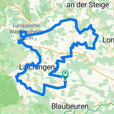
 Südalb: Bermaringen-Mochental
- Distance
- 50.2 km
- Ascent
- 611 m
- Descent
- 698 m
- Location
- Berghülen, Baden-Wurttemberg, Germany
 Kleines Lautertal
- Distance
- 43.8 km
- Ascent
- 342 m
- Descent
- 343 m
- Location
- Berghülen, Baden-Wurttemberg, Germany
 Sonntags Runde
- Distance
- 18 km
- Ascent
- 273 m
- Descent
- 273 m
- Location
- Berghülen, Baden-Wurttemberg, Germany
 Lautertal-Runde
- Distance
- 37.3 km
- Ascent
- 465 m
- Descent
- 465 m
- Location
- Berghülen, Baden-Wurttemberg, Germany
 Berghülen - Lämmerbuckel
- Distance
- 16.6 km
- Ascent
- 272 m
- Descent
- 158 m
- Location
- Berghülen, Baden-Wurttemberg, Germany
 Lautertal-Runde
- Distance
- 37.3 km
- Ascent
- 472 m
- Descent
- 472 m
- Location
- Berghülen, Baden-Wurttemberg, Germany
 Berghülen - Aufhausen - Laichingen - Berghülen
- Distance
- 93.2 km
- Ascent
- 572 m
- Descent
- 571 m
- Location
- Berghülen, Baden-Wurttemberg, Germany
 Halbschatten Tour
- Distance
- 17.2 km
- Ascent
- 212 m
- Descent
- 211 m
- Location
- Berghülen, Baden-Wurttemberg, Germany
Open it in the app