

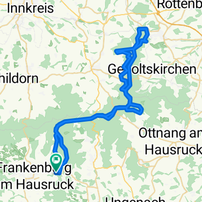
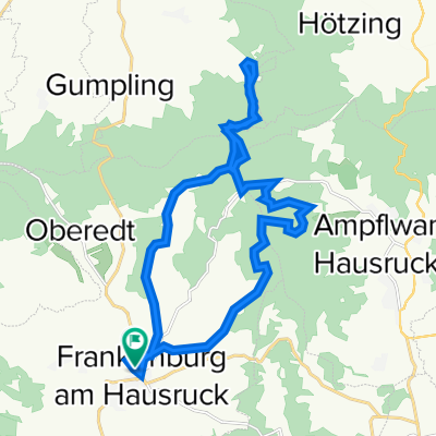
Frankenburg - Alpe Berg - Gahberg MTB Runde
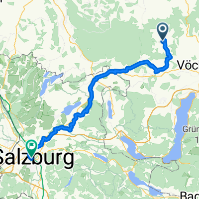
A cycling route starting in Frankenburg, Upper Austria, Austria.
Overview
About this route
- -:--
- Duration
- 77.3 km
- Distance
- 1,210 m
- Ascent
- 1,208 m
- Descent
- ---
- Avg. speed
- 917 m
- Max. altitude

Route photos


Route quality
Waytypes & surfaces along the route
Waytypes
Quiet road
37.1 km
(48 %)
Track
16.2 km
(21 %)
Surfaces
Paved
34 km
(44 %)
Unpaved
17 km
(22 %)
Asphalt
33.2 km
(43 %)
Gravel
13.1 km
(17 %)
Continue with Bikemap
Use, edit, or download this cycling route
You would like to ride Frankenburg - Alpe Berg - Gahberg MTB Runde or customize it for your own trip? Here is what you can do with this Bikemap route:
Free features
- Save this route as favorite or in collections
- Copy & plan your own version of this route
- Sync your route with Garmin or Wahoo
Premium features
Free trial for 3 days, or one-time payment. More about Bikemap Premium.
- Navigate this route on iOS & Android
- Export a GPX / KML file of this route
- Create your custom printout (try it for free)
- Download this route for offline navigation
Discover more Premium features.
Get Bikemap PremiumFrom our community
Other popular routes starting in Frankenburg
 L509 nach Rathausplatz
- Distance
- 70.4 km
- Ascent
- 834 m
- Descent
- 931 m
- Location
- Frankenburg, Upper Austria, Austria
 Frankenburg-Haag-Variante
- Distance
- 48.9 km
- Ascent
- 847 m
- Descent
- 847 m
- Location
- Frankenburg, Upper Austria, Austria
 Prameter Badesee / Göblberg / Hausruckrunde
- Distance
- 25.8 km
- Ascent
- 582 m
- Descent
- 561 m
- Location
- Frankenburg, Upper Austria, Austria
 Frankenburg - Gipfelstürmer
- Distance
- 43.4 km
- Ascent
- 705 m
- Descent
- 705 m
- Location
- Frankenburg, Upper Austria, Austria
 Frankenburg - Alpe Berg - Gahberg MTB Runde
- Distance
- 77.3 km
- Ascent
- 1,210 m
- Descent
- 1,208 m
- Location
- Frankenburg, Upper Austria, Austria
 Pettenfürsthütte
- Distance
- 35 km
- Ascent
- 849 m
- Descent
- 848 m
- Location
- Frankenburg, Upper Austria, Austria
 Vöcklamarkter Straße nach Rathausplatz
- Distance
- 59 km
- Ascent
- 803 m
- Descent
- 901 m
- Location
- Frankenburg, Upper Austria, Austria
 Göblberg+Badesee mit längerem Trail
- Distance
- 21.9 km
- Ascent
- 579 m
- Descent
- 578 m
- Location
- Frankenburg, Upper Austria, Austria
Open it in the app