

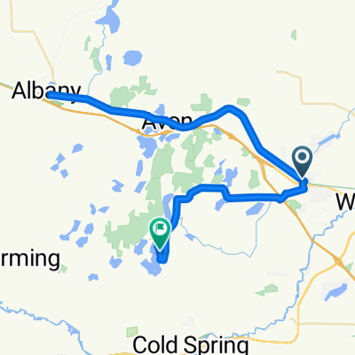
255–301 College Ave S, Saint Joseph to 2001 Frontage Rd N, Waite Park
A cycling route starting in Saint Joseph, Minnesota, United States.
Overview
About this route
- 2 h 17 min
- Duration
- 26.4 km
- Distance
- 53 m
- Ascent
- 69 m
- Descent
- 11.6 km/h
- Avg. speed
- 341 m
- Max. altitude

Route quality
Waytypes & surfaces along the route
Waytypes
Cycleway
14.2 km
(54 %)
Road
4.2 km
(16 %)
Surfaces
Paved
20.6 km
(78 %)
Asphalt
18.2 km
(69 %)
Concrete
2.4 km
(9 %)
Undefined
5.8 km
(22 %)
Continue with Bikemap
Use, edit, or download this cycling route
You would like to ride 255–301 College Ave S, Saint Joseph to 2001 Frontage Rd N, Waite Park or customize it for your own trip? Here is what you can do with this Bikemap route:
Free features
- Save this route as favorite or in collections
- Copy & plan your own version of this route
- Sync your route with Garmin or Wahoo
Premium features
Free trial for 3 days, or one-time payment. More about Bikemap Premium.
- Navigate this route on iOS & Android
- Export a GPX / KML file of this route
- Create your custom printout (try it for free)
- Download this route for offline navigation
Discover more Premium features.
Get Bikemap PremiumFrom our community
Other popular routes starting in Saint Joseph
 Mabbotts to Swansons
- Distance
- 6.9 km
- Ascent
- 6 m
- Descent
- 15 m
- Location
- Saint Joseph, Minnesota, United States
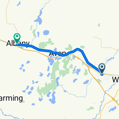
 251–253 College Ave S, Saint Joseph to 255–301 College Ave S, Saint Joseph
- Distance
- 4.5 km
- Ascent
- 167 m
- Descent
- 166 m
- Location
- Saint Joseph, Minnesota, United States
 tour of saints
- Distance
- 80.3 km
- Ascent
- 606 m
- Descent
- 602 m
- Location
- Saint Joseph, Minnesota, United States
 Lake Wobegon Trail
- Distance
- 77.8 km
- Ascent
- 151 m
- Descent
- 75 m
- Location
- Saint Joseph, Minnesota, United States
 Lake Wobegan Trail, Saint Joseph to Hidden Cove Rd, Cold Spring
- Distance
- 64.4 km
- Ascent
- 284 m
- Descent
- 246 m
- Location
- Saint Joseph, Minnesota, United States
 Century Ride (St. Joseph > Osakis)
- Distance
- 82 km
- Ascent
- 342 m
- Descent
- 247 m
- Location
- Saint Joseph, Minnesota, United States
 College Avenue North to Railroad Avenue
- Distance
- 23.9 km
- Ascent
- 81 m
- Descent
- 52 m
- Location
- Saint Joseph, Minnesota, United States
 Day 21 Lag2
- Distance
- 14.2 km
- Ascent
- 20 m
- Descent
- 35 m
- Location
- Saint Joseph, Minnesota, United States
Open it in the app