

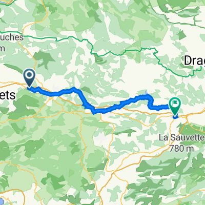
De N7, Pourrières à Liberation, Nice
A cycling route starting in Pourrières, Provence-Alpes-Côte d'Azur Region, France.
Overview
About this route
- 7 h 57 min
- Duration
- 156.2 km
- Distance
- 1,972 m
- Ascent
- 2,257 m
- Descent
- 19.7 km/h
- Avg. speed
- 403 m
- Max. altitude

Route quality
Waytypes & surfaces along the route
Waytypes
Busy road
99.7 km
(64 %)
Road
16.1 km
(10 %)
Surfaces
Paved
97.2 km
(62 %)
Unpaved
4.3 km
(3 %)
Asphalt
96.6 km
(62 %)
Ground
4.2 km
(3 %)
Continue with Bikemap
Use, edit, or download this cycling route
You would like to ride De N7, Pourrières à Liberation, Nice or customize it for your own trip? Here is what you can do with this Bikemap route:
Free features
- Save this route as favorite or in collections
- Copy & plan your own version of this route
- Split it into stages to create a multi-day tour
- Sync your route with Garmin or Wahoo
Premium features
Free trial for 3 days, or one-time payment. More about Bikemap Premium.
- Navigate this route on iOS & Android
- Export a GPX / KML file of this route
- Create your custom printout (try it for free)
- Download this route for offline navigation
Discover more Premium features.
Get Bikemap PremiumFrom our community
Other popular routes starting in Pourrières
 Col des Portes et Grand Sambuc
- Distance
- 57.8 km
- Ascent
- 762 m
- Descent
- 761 m
- Location
- Pourrières, Provence-Alpes-Côte d'Azur Region, France
 Mont Sainte Victoire
- Distance
- 63.6 km
- Ascent
- 879 m
- Descent
- 878 m
- Location
- Pourrières, Provence-Alpes-Côte d'Azur Region, France
 1 Rue Marius Bourrelly, Pourcieux to 5 Avenue Pierre Gaudin, Le Luc
- Distance
- 58.6 km
- Ascent
- 674 m
- Descent
- 860 m
- Location
- Pourrières, Provence-Alpes-Côte d'Azur Region, France
 Pourrieres-rians-varages-st maximin-trets-Pourrières
- Distance
- 77 km
- Ascent
- 605 m
- Descent
- 605 m
- Location
- Pourrières, Provence-Alpes-Côte d'Azur Region, France
 D 623, Pourrières à 365E Chemin de Belle Vue, Pourrières
- Distance
- 29.3 km
- Ascent
- 436 m
- Descent
- 405 m
- Location
- Pourrières, Provence-Alpes-Côte d'Azur Region, France
 Monext : Ironman Pays d'Aix Part 2
- Distance
- 31.2 km
- Ascent
- 424 m
- Descent
- 543 m
- Location
- Pourrières, Provence-Alpes-Côte d'Azur Region, France
 Sainte-Victoire / Verdon
- Distance
- 71.2 km
- Ascent
- 878 m
- Descent
- 882 m
- Location
- Pourrières, Provence-Alpes-Côte d'Azur Region, France
 De N7, Pourrières à Liberation, Nice
- Distance
- 156.2 km
- Ascent
- 1,972 m
- Descent
- 2,257 m
- Location
- Pourrières, Provence-Alpes-Côte d'Azur Region, France
Open it in the app