

2022_Oberst-Klinkerhütte
A cycling route starting in Treglwang, Styria, Austria.
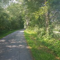
Overview
About this route
19.07.2022
- -:--
- Duration
- 72.3 km
- Distance
- 1,384 m
- Ascent
- 1,382 m
- Descent
- ---
- Avg. speed
- 1,483 m
- Max. altitude

Route quality
Waytypes & surfaces along the route
Waytypes
Quiet road
27.2 km
(38 %)
Busy road
14.2 km
(20 %)
Surfaces
Paved
24.9 km
(34 %)
Unpaved
9.6 km
(13 %)
Asphalt
23.9 km
(33 %)
Unpaved (undefined)
8.2 km
(11 %)
Continue with Bikemap
Use, edit, or download this cycling route
You would like to ride 2022_Oberst-Klinkerhütte or customize it for your own trip? Here is what you can do with this Bikemap route:
Free features
- Save this route as favorite or in collections
- Copy & plan your own version of this route
- Sync your route with Garmin or Wahoo
Premium features
Free trial for 3 days, or one-time payment. More about Bikemap Premium.
- Navigate this route on iOS & Android
- Export a GPX / KML file of this route
- Create your custom printout (try it for free)
- Download this route for offline navigation
Discover more Premium features.
Get Bikemap PremiumFrom our community
Other popular routes starting in Treglwang
 2022_Hölleralm
- Distance
- 40.5 km
- Ascent
- 1,208 m
- Descent
- 1,206 m
- Location
- Treglwang, Styria, Austria
 solo_23_4_Gais am See - Mooslandl
- Distance
- 74.3 km
- Ascent
- 1,080 m
- Descent
- 1,259 m
- Location
- Treglwang, Styria, Austria
 Treglwang - Bruck
- Distance
- 74.6 km
- Ascent
- 402 m
- Descent
- 618 m
- Location
- Treglwang, Styria, Austria
 2021_Gaishorn am See-Hölleralm
- Distance
- 40.8 km
- Ascent
- 884 m
- Descent
- 885 m
- Location
- Treglwang, Styria, Austria
 2022_Hasensattel Runde
- Distance
- 52.4 km
- Ascent
- 1,279 m
- Descent
- 1,279 m
- Location
- Treglwang, Styria, Austria
 2022_Oberst-Klinkerhütte
- Distance
- 72.3 km
- Ascent
- 1,384 m
- Descent
- 1,382 m
- Location
- Treglwang, Styria, Austria
 r15 auf r7 nach (Nieder-) Öblarn
- Distance
- 70.5 km
- Ascent
- 236 m
- Descent
- 303 m
- Location
- Treglwang, Styria, Austria
 solo_2024_32_Gaishorn-
- Distance
- 82.7 km
- Ascent
- 732 m
- Descent
- 759 m
- Location
- Treglwang, Styria, Austria
Open it in the app